
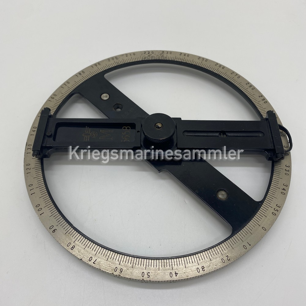
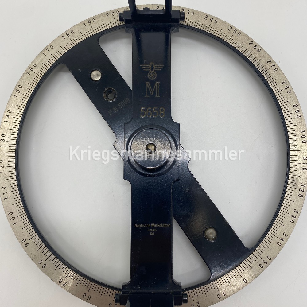
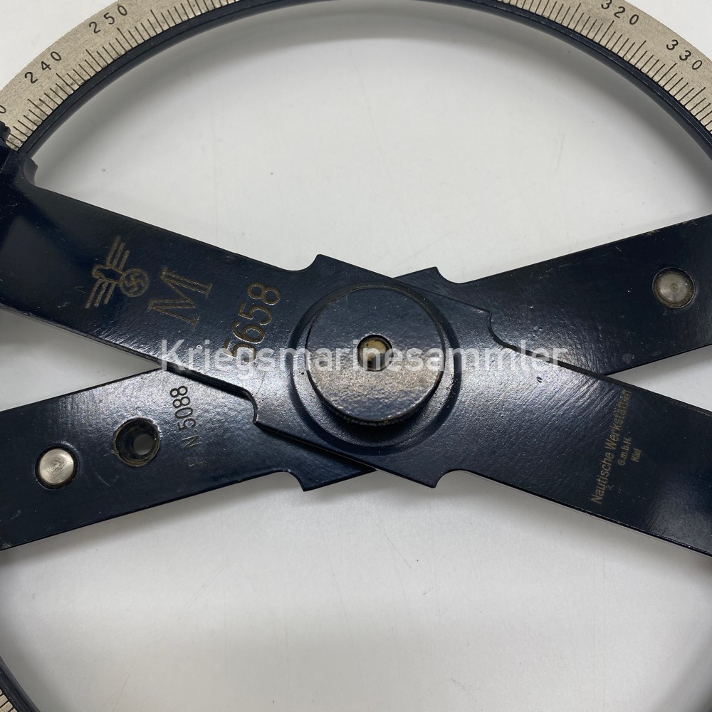
U-Boot Angriffsscheibe Lagenwinkelscheibe Extremely Rare!
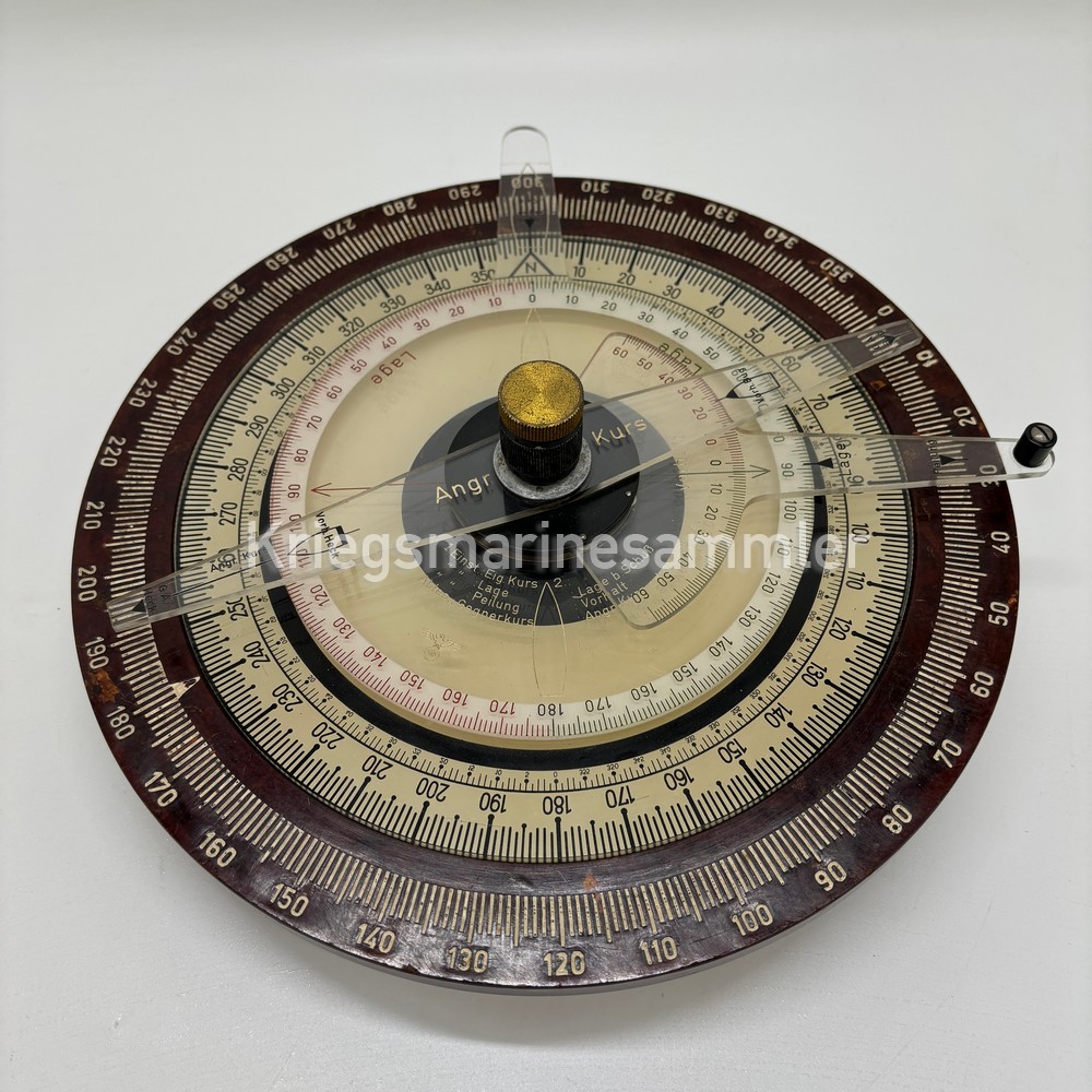
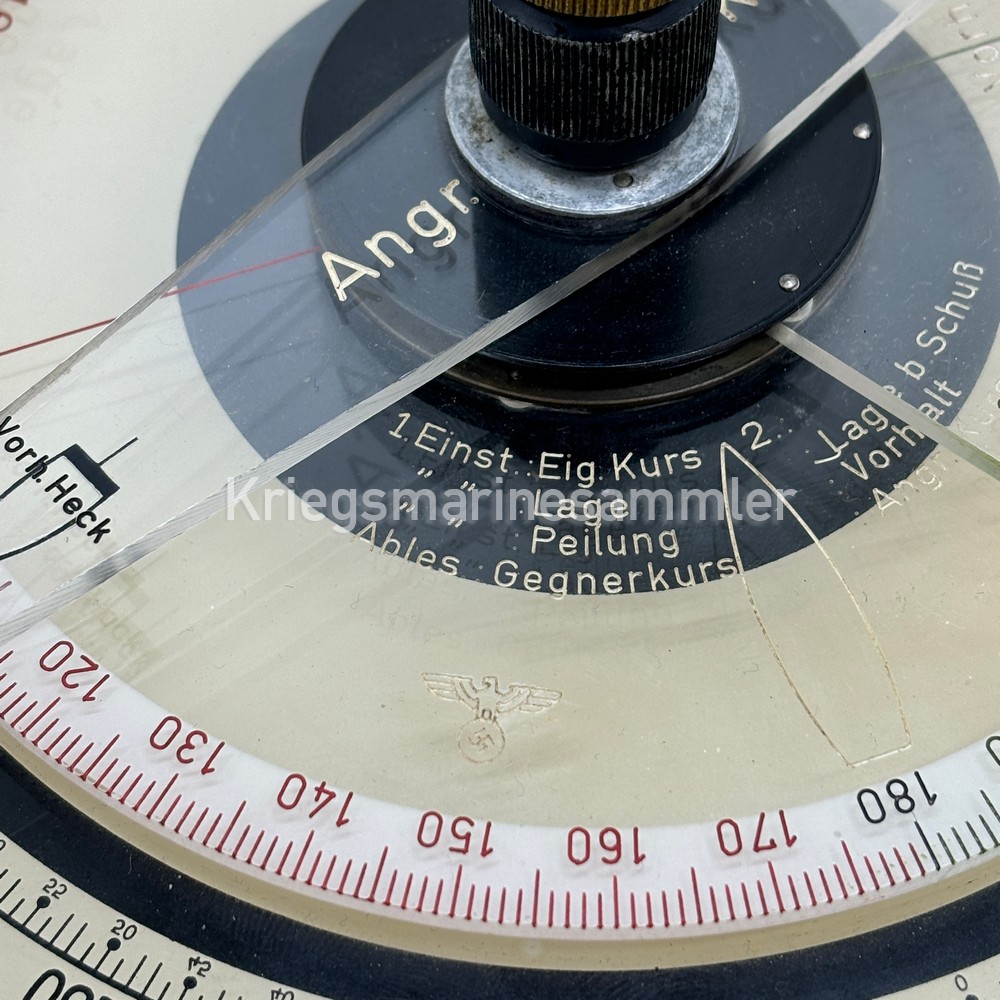


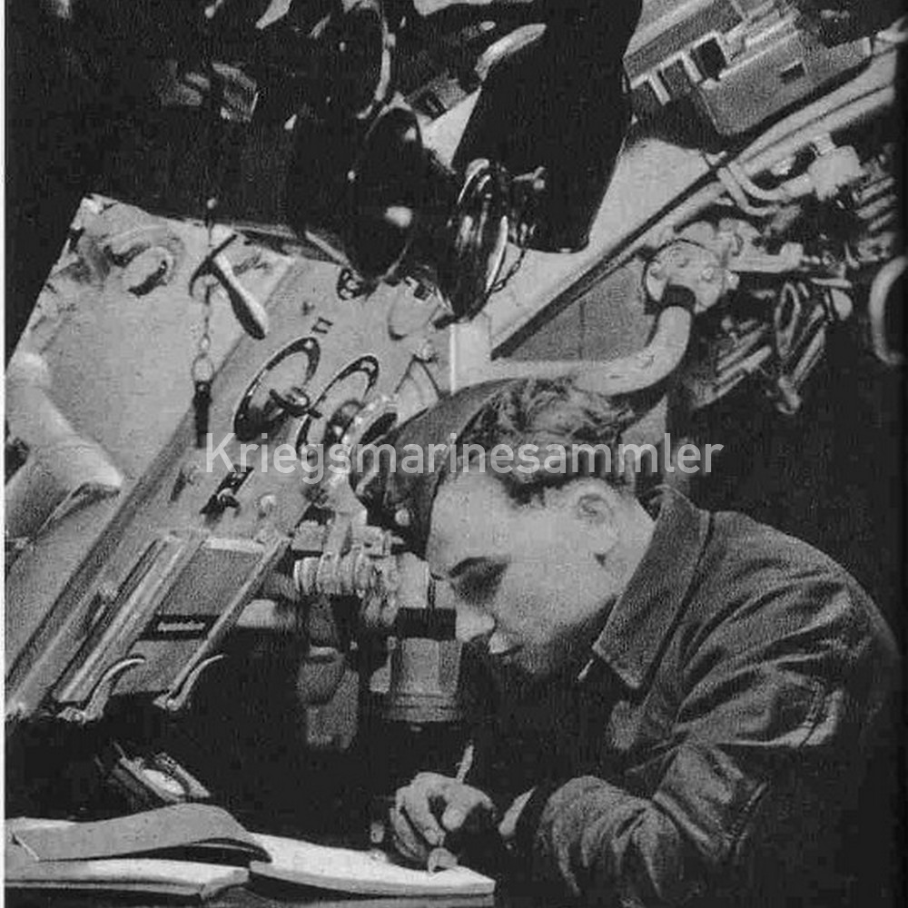
U-Boot Angriffsscheibe made by Dennert & Pape. Only used for U-Boot Crews, this handheld device was used to Calculate the Approach course, Targets Course, Real Target bearing and Angle on the bow & more! This device is very rare! It’s nicely marked on the plexi having all of its discs without any damage. Handle on bottom is missing.
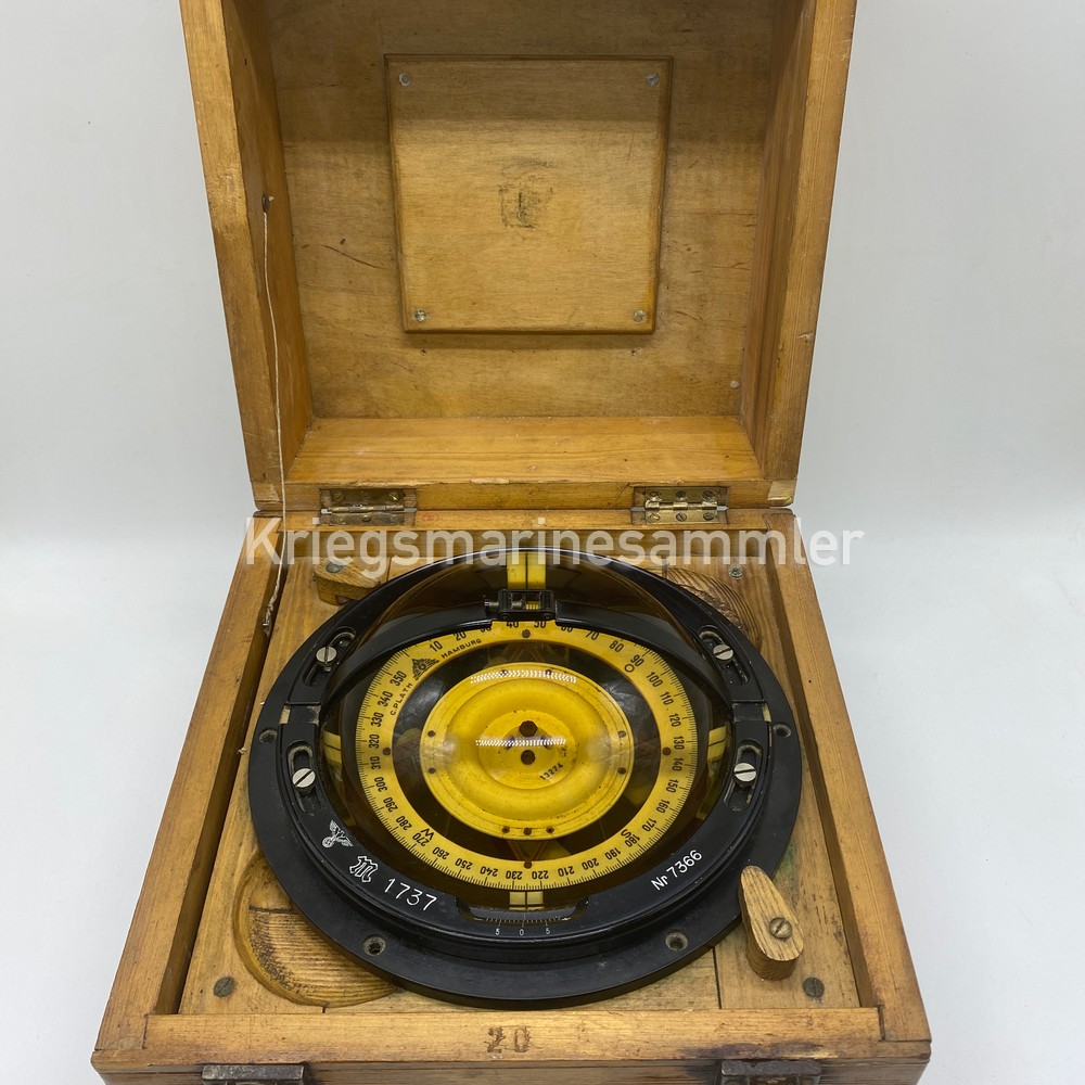
Kriegsmarine U-Boot Lufft Barometer
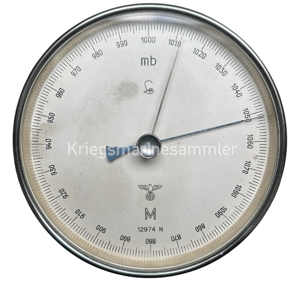
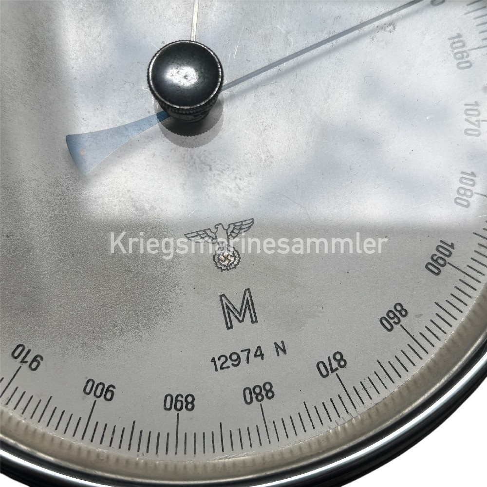
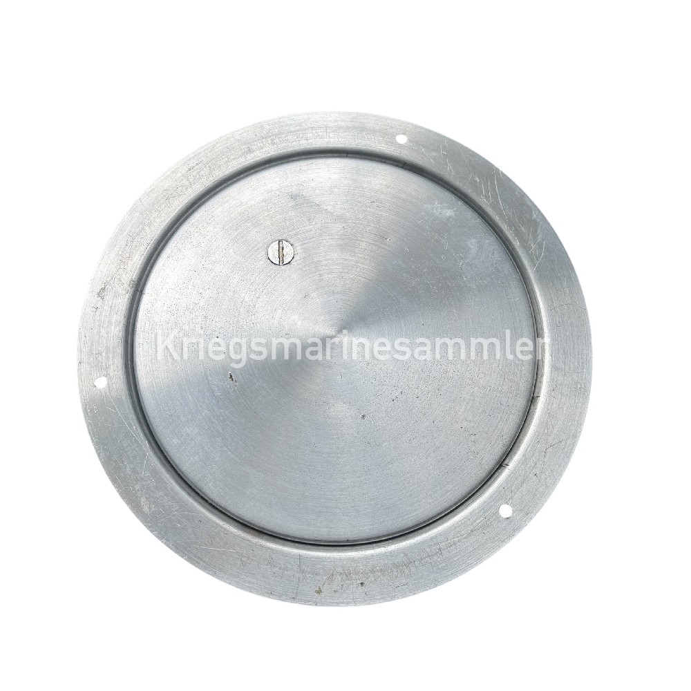
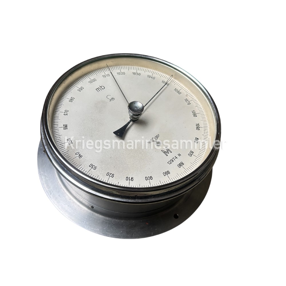

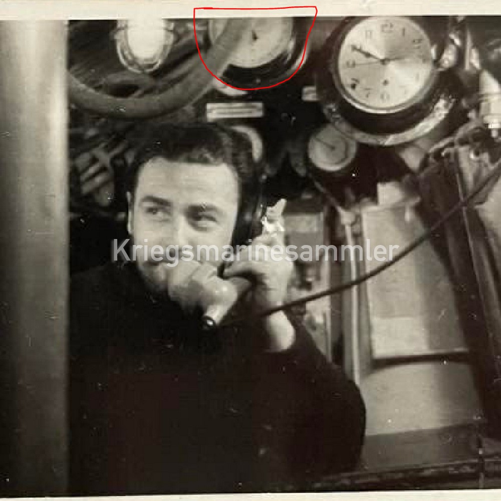
Barometer produced by Lufft, used on U-Boots as seen in the picture but also used on many other vessels. Very important instrument regarding weather, artillery calculation, or pressure inside the U-Boot. A Very nice example in good condition and intact. Nicely marked on the dial with some small scratches on the cross but not damaged!
Kriegsmarine U-Boot C. Plath Hamburg Sextant


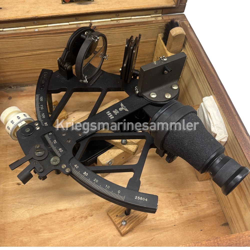

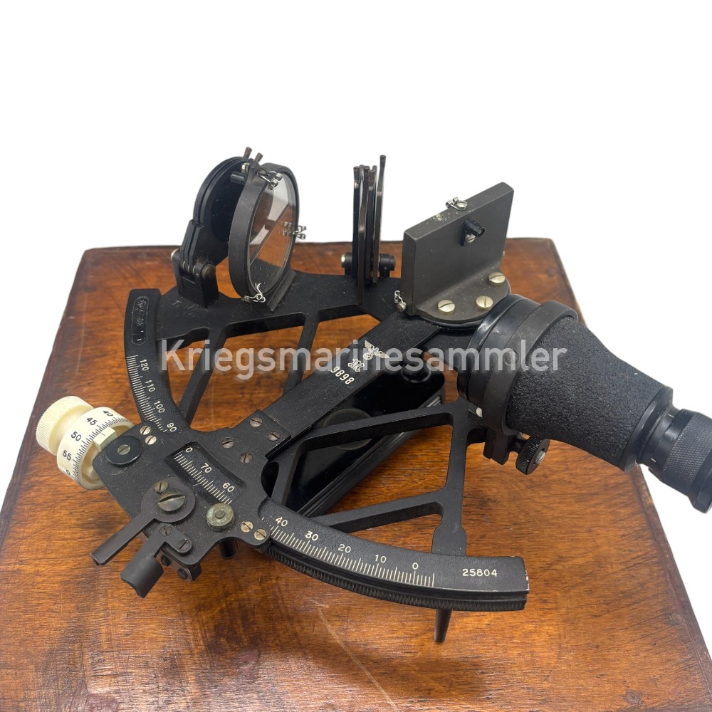
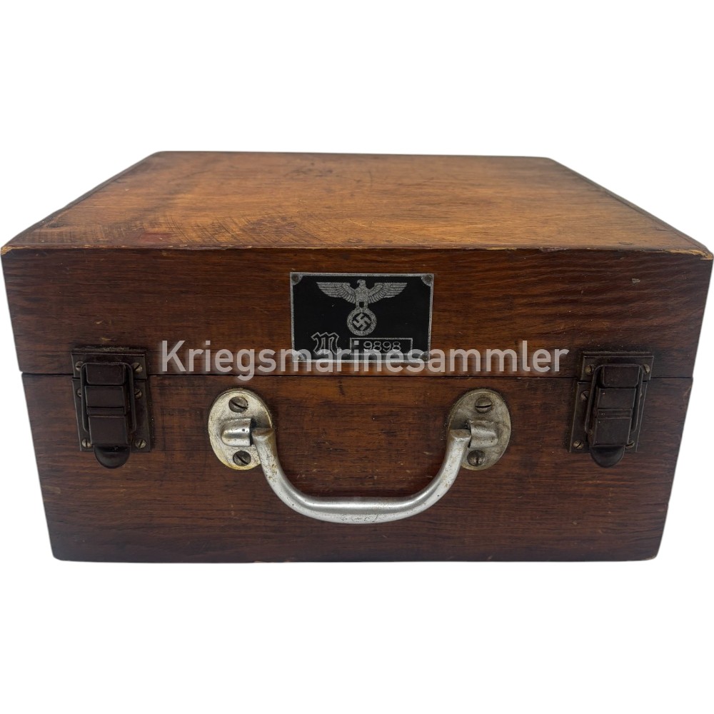
Complete set of a Kriegsmarine Sextant. Produced by C. Plath Hamburg. Used in U-Boot and other Kriegsmarine Vessels. This Original Kriegsmarine Sexant is a late model made in 1944 which can be determined by the late war Serial nr and the original acceptance paper which comes complete with every part and also its very rare plate on the front. All items are in very well condition.
This sexant would be used to determain their position by measuring angle of the Sun and the Horizon of the Sea. With this information of their current angle and time it was determained they need to calcutate their position line on a chart and Hereby know their current Location on the Ocean/Sea. This is one of the most common Typical Nautical instruments.
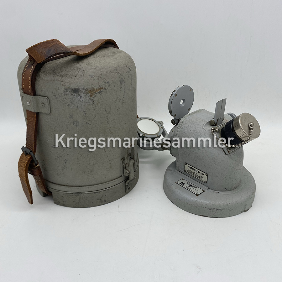
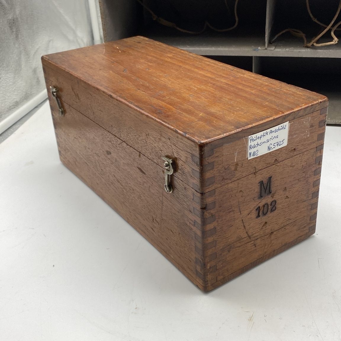
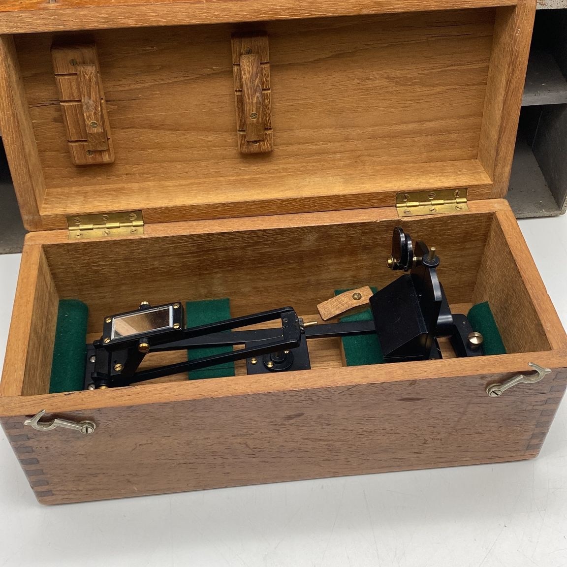
U-Boot Druckfester Peildiopter Azimuth


A U-Boot Druckfester/Pressure tight Peildiopter/Azimuth Model S1350 made by Anschütz Kiel for the Pressure Tight Tochterkompass mounted on the Bridge. This device is Extremely rare to find, especially complete with its metal case. This device has the same use as any other Peildiopter/Azimuth but can be left on the bridge when Crash diving withstanding 250 Meters depth. This device Only fits on the U-Boot Pressure Tight Tochterkompass model S2251 on the Bridge.
Kriegsmarine U-Boot C. Plath Hamburg Sextant


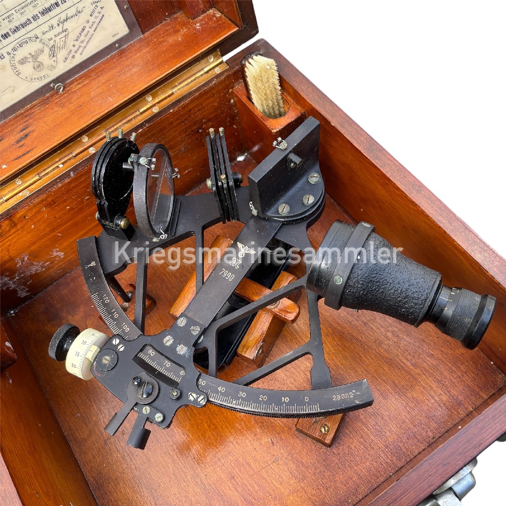

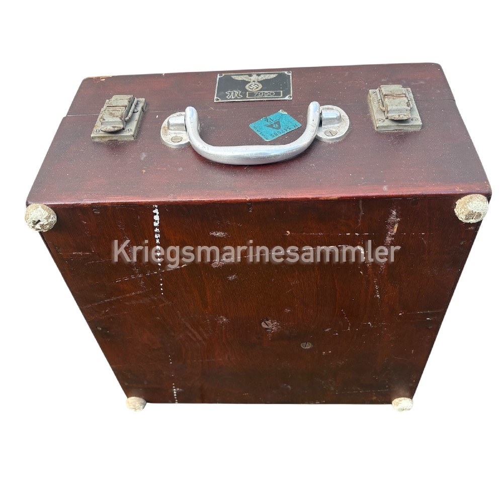
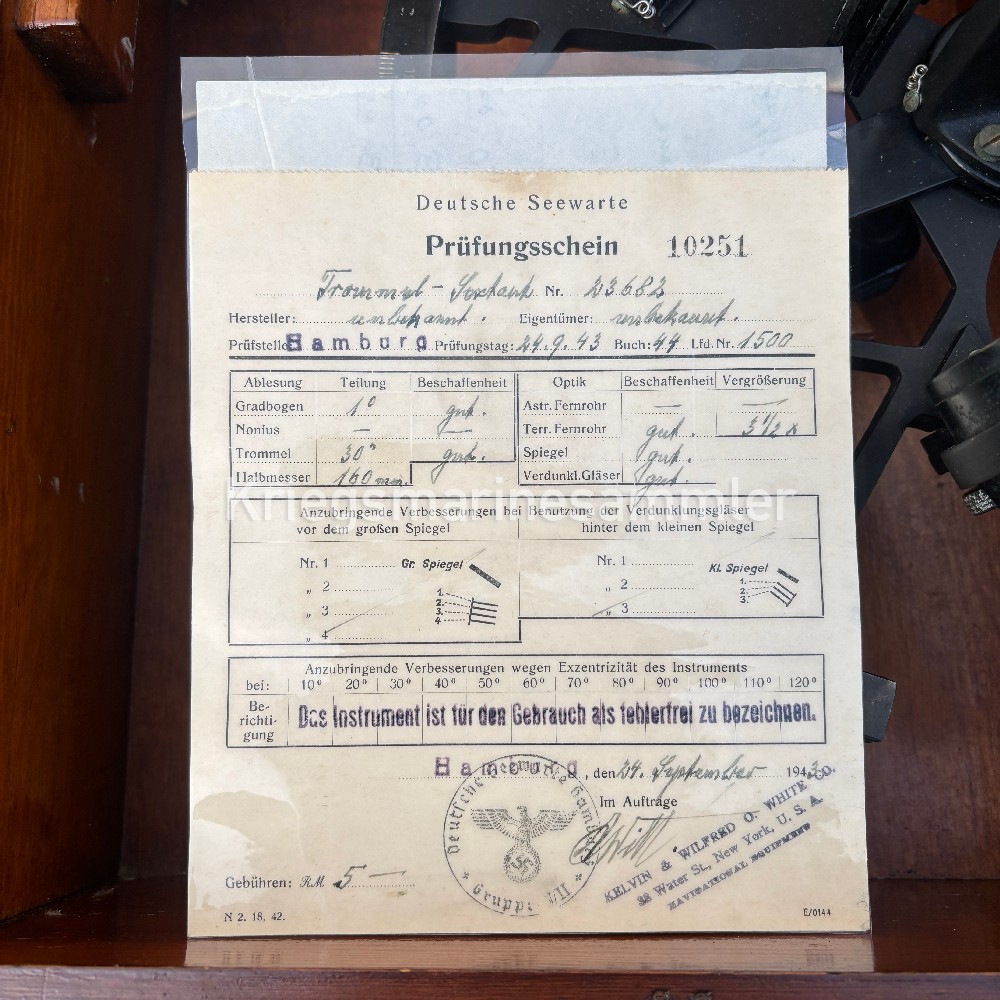
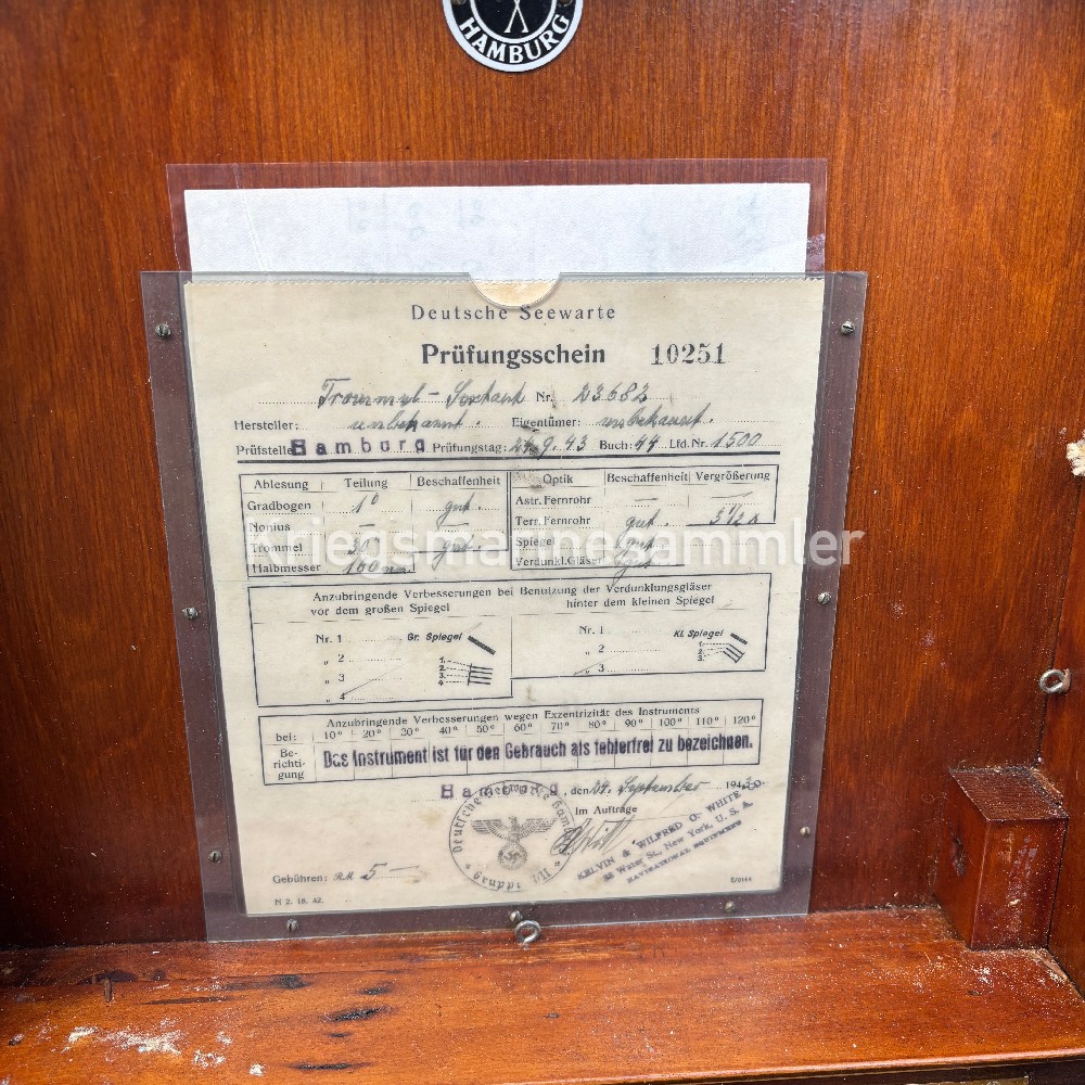
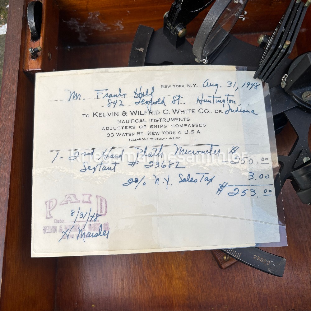
Complete set of a Kriegsmarine Sextant. Produced by C. Plath Hamburg. Used in U-Boot and other Kriegsmarine Vessels. This Original Kriegsmarine Sexant is a later model which comes complete with every part and also its very rare plate on the front. All items are in very well condition. Very likely this sextant was brought back to the States as a bringback after the war. The Paper is original but it comes Plastified together with the USA acceptance paper. The sextants box has 4 notches on the bottom to protect the case. This sexant would be used to determain their position by measuring angle of the Sun and the Horizon of the Sea. With this information of their current angle and time it was determained they need to calcutate their position line on a chart and Hereby know their current Location on the Ocean/Sea.
Kriegsmarine Marineschule Kiel Rechenschieber calculating rulers
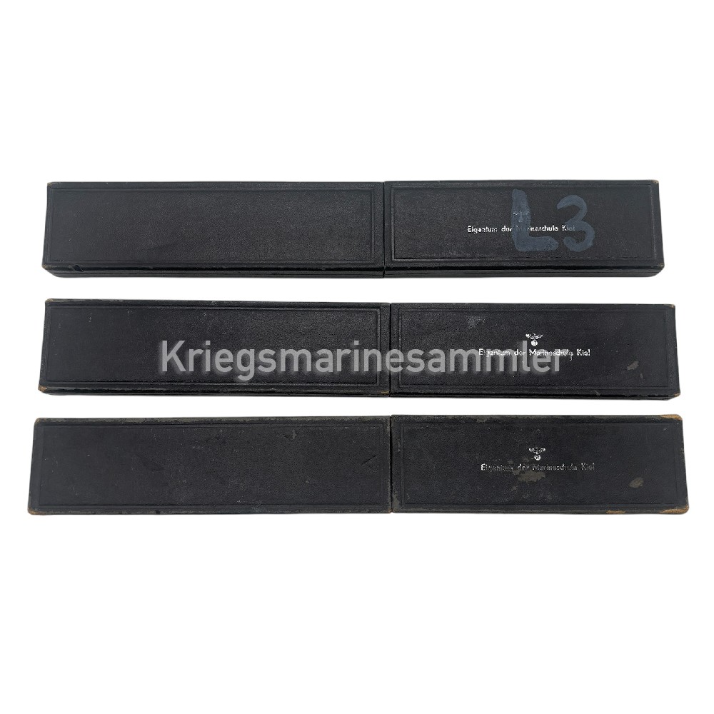
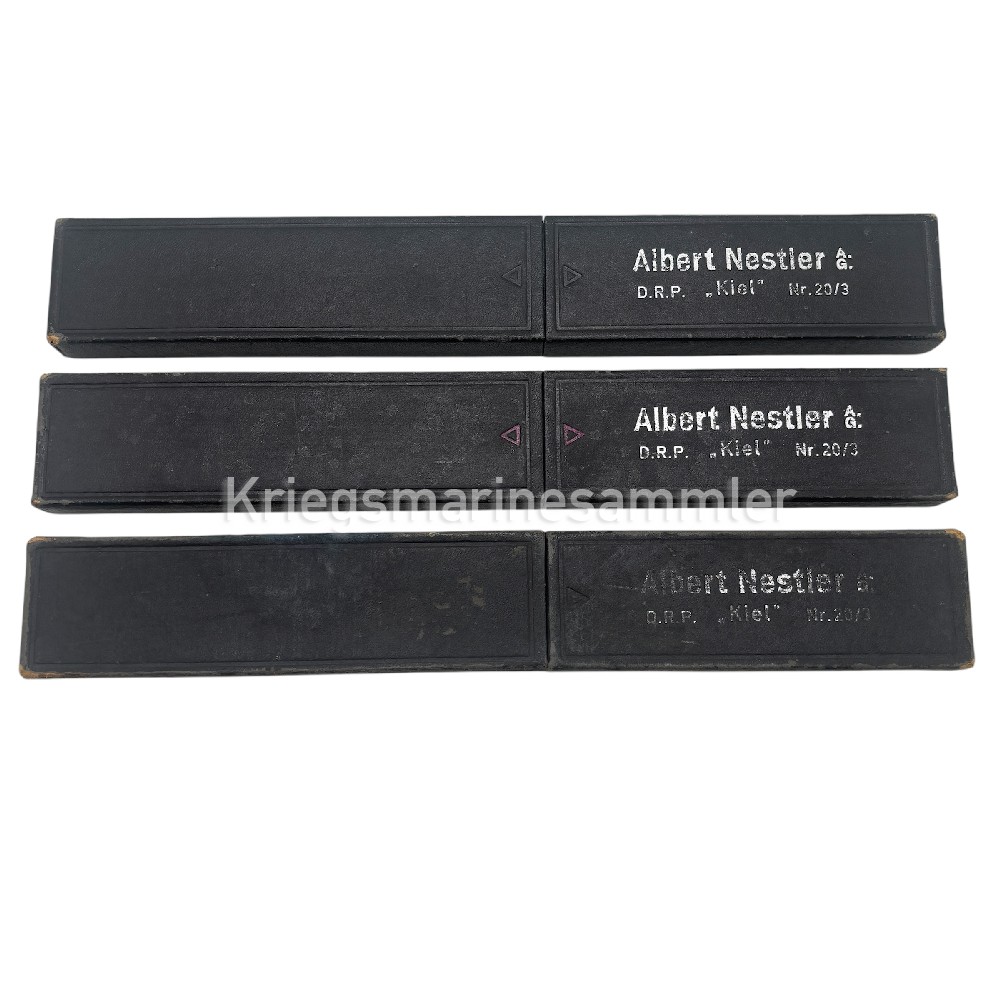

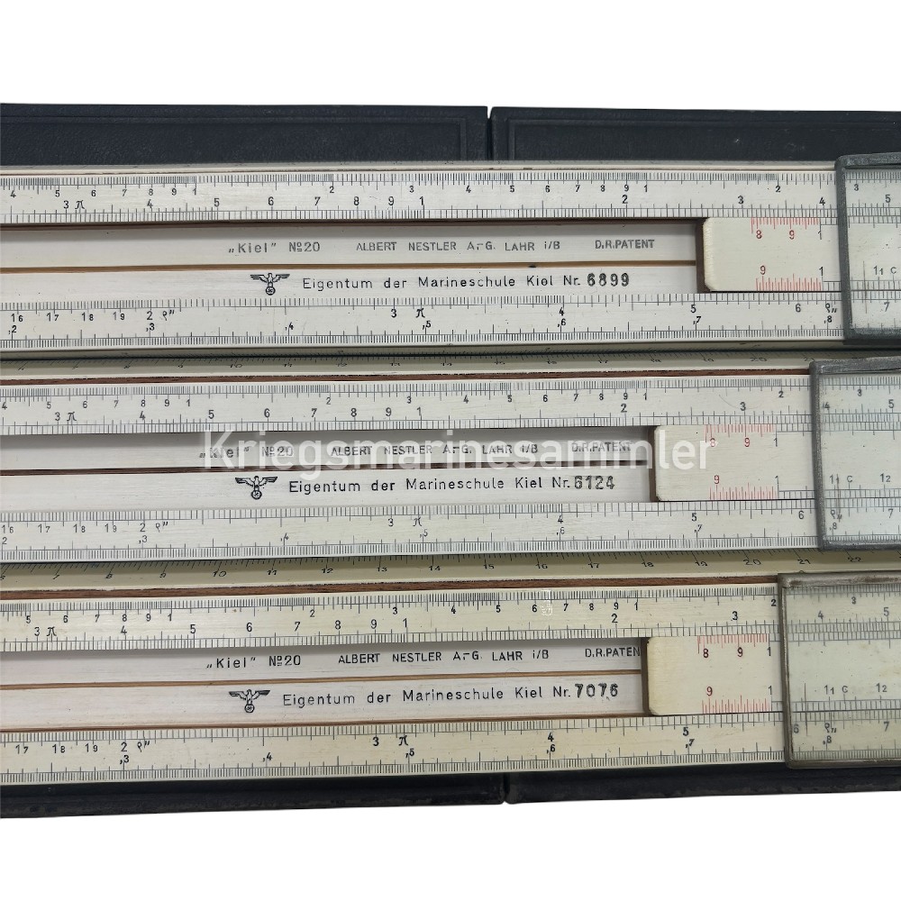
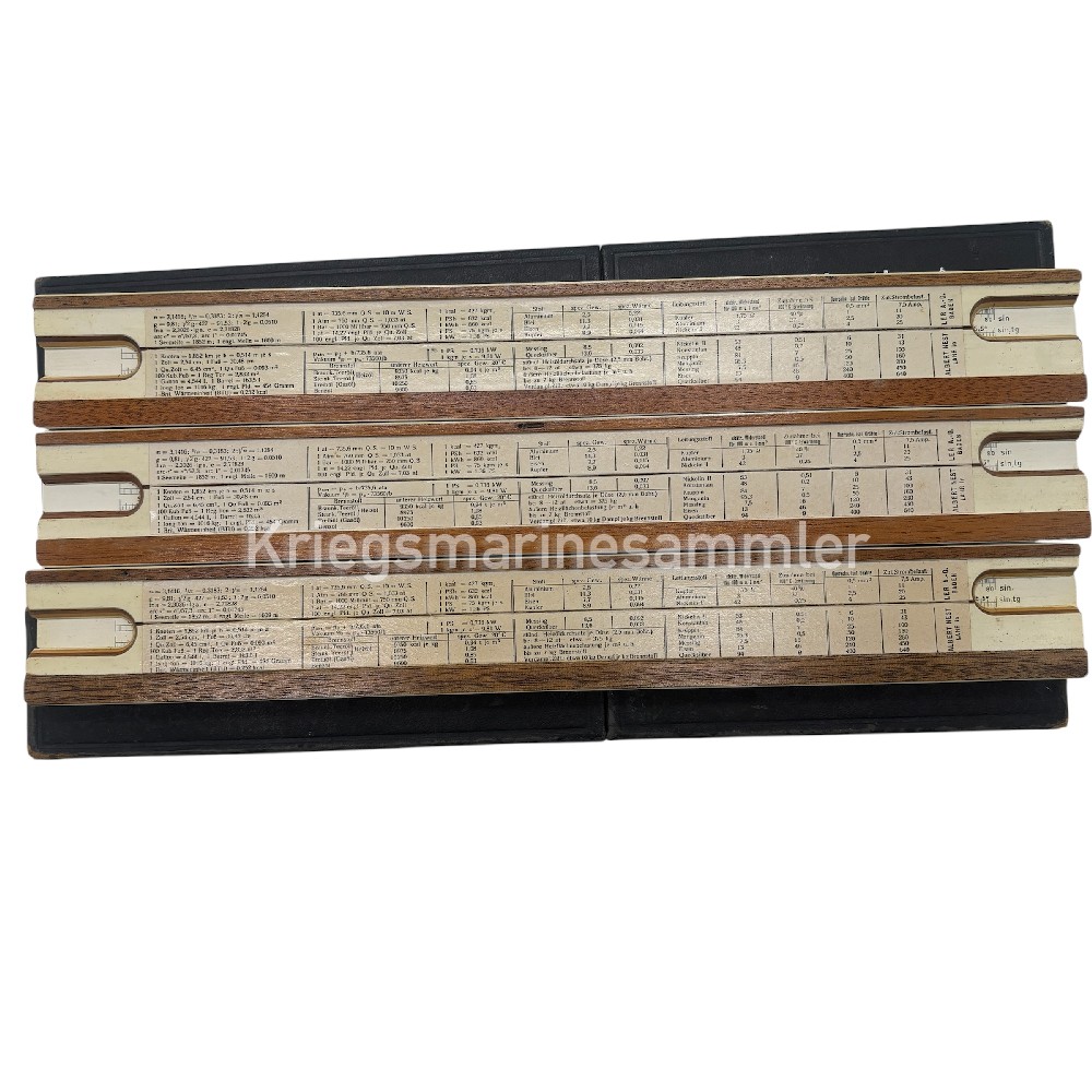
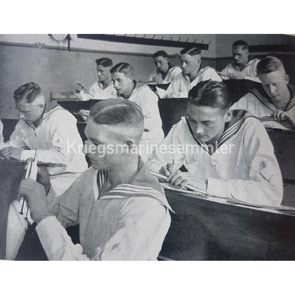
3x Rechenschieber/ Calculating Rulers, these exact ones where specifically used in the Marineschule of Kiel, the picture added shows students of the school using this exact tool. They are nicely marked as seen in the picture,
Kriegsmarine U-Boot Zirkelkasten Compass Dividers
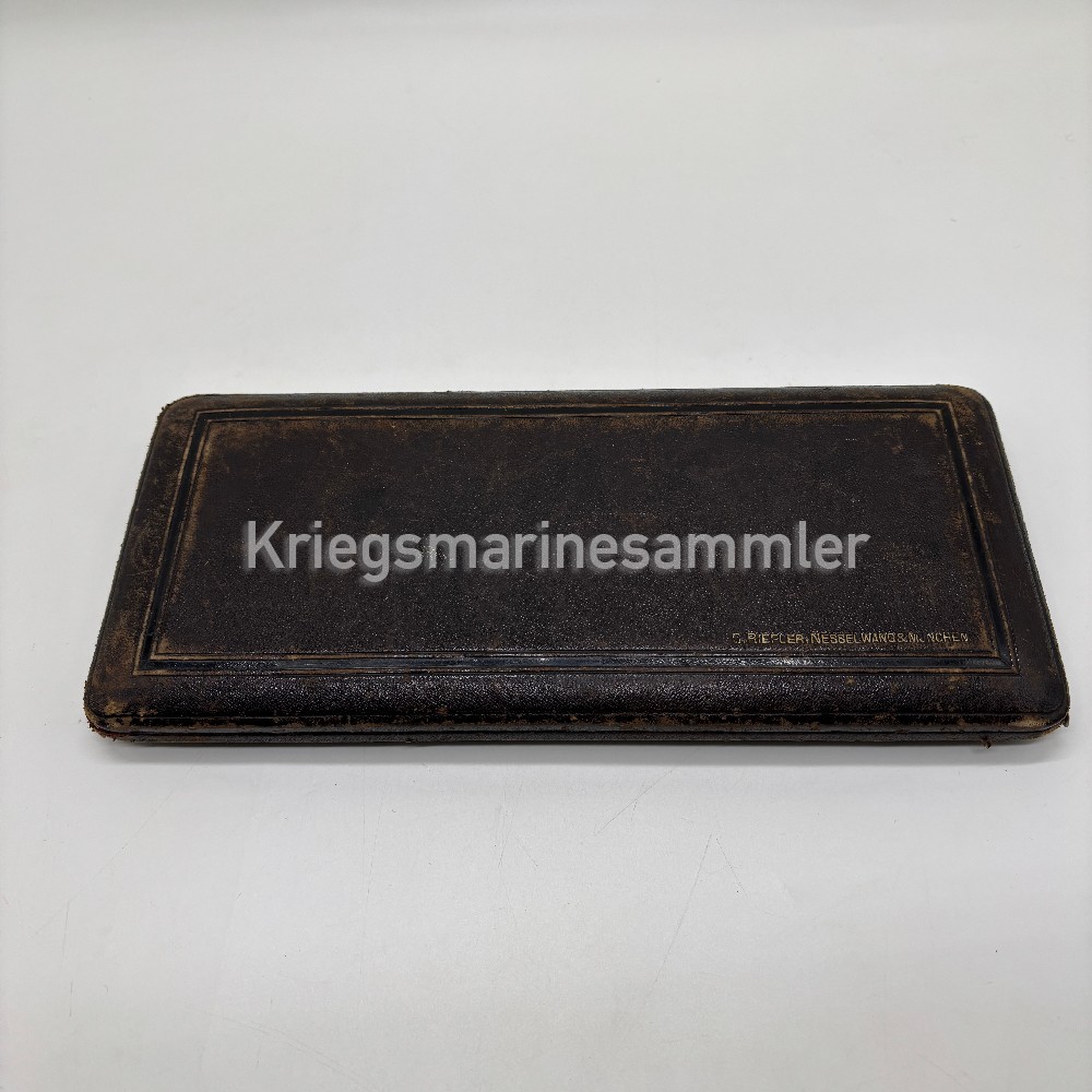
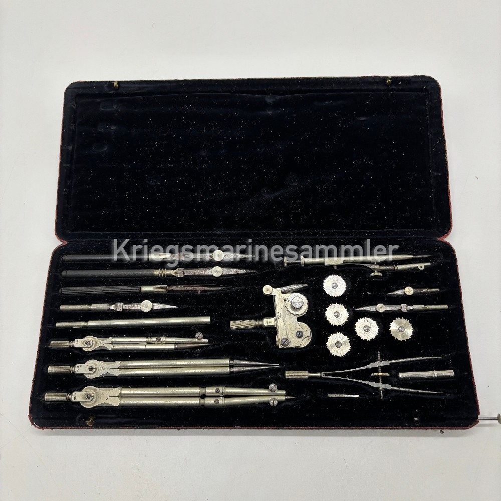


Kriegsmarine U-Boot Zirkelkasten/Compass divider set from C.Riefler. Very important tools for navigation and calculating trajectories. Very nice KM marked Set with multiple tools marked.
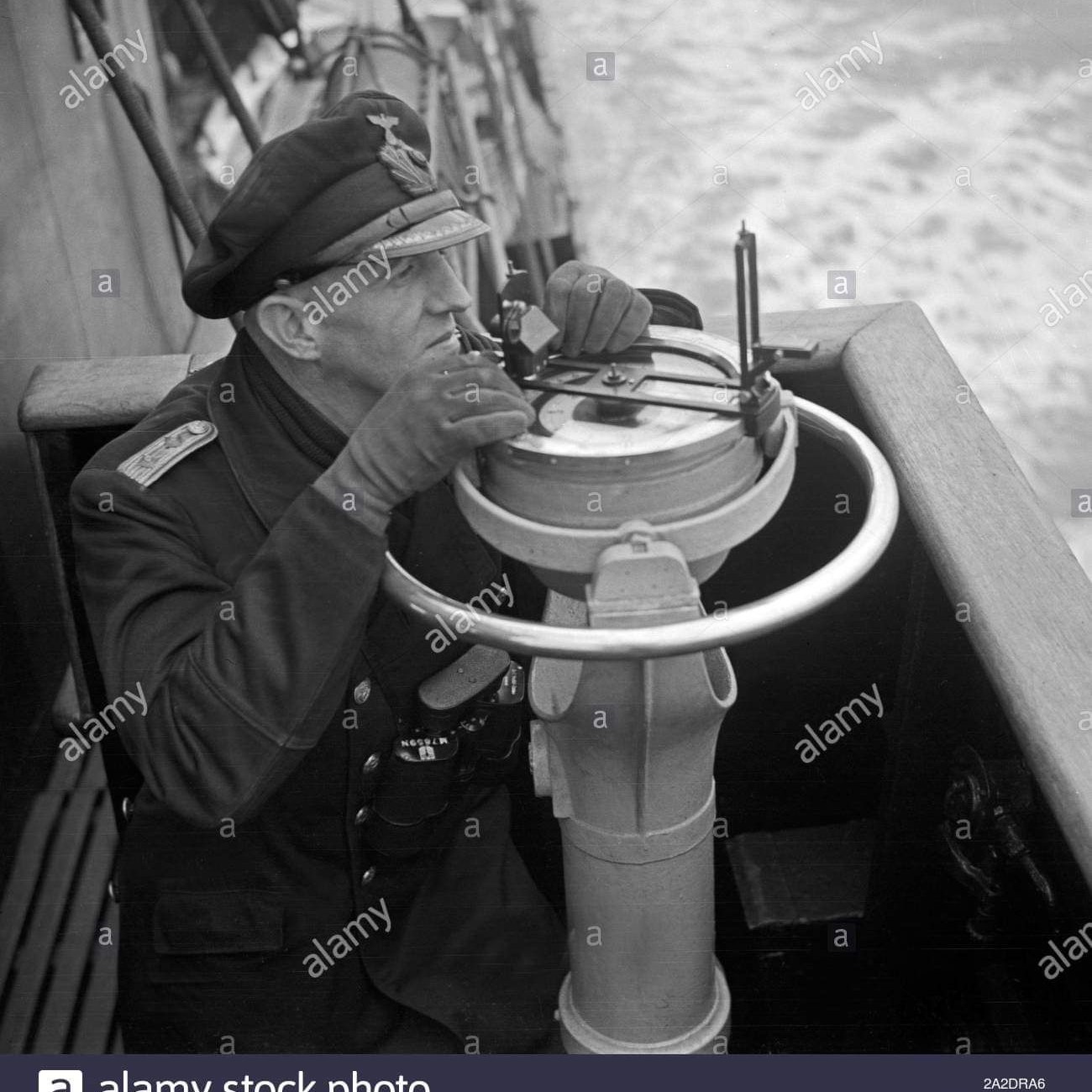
Kriegsmarine U-Boot Late war Peilscheibe
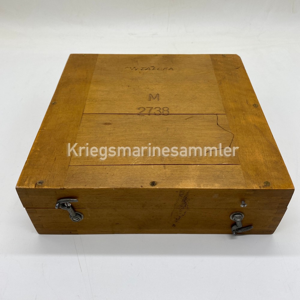

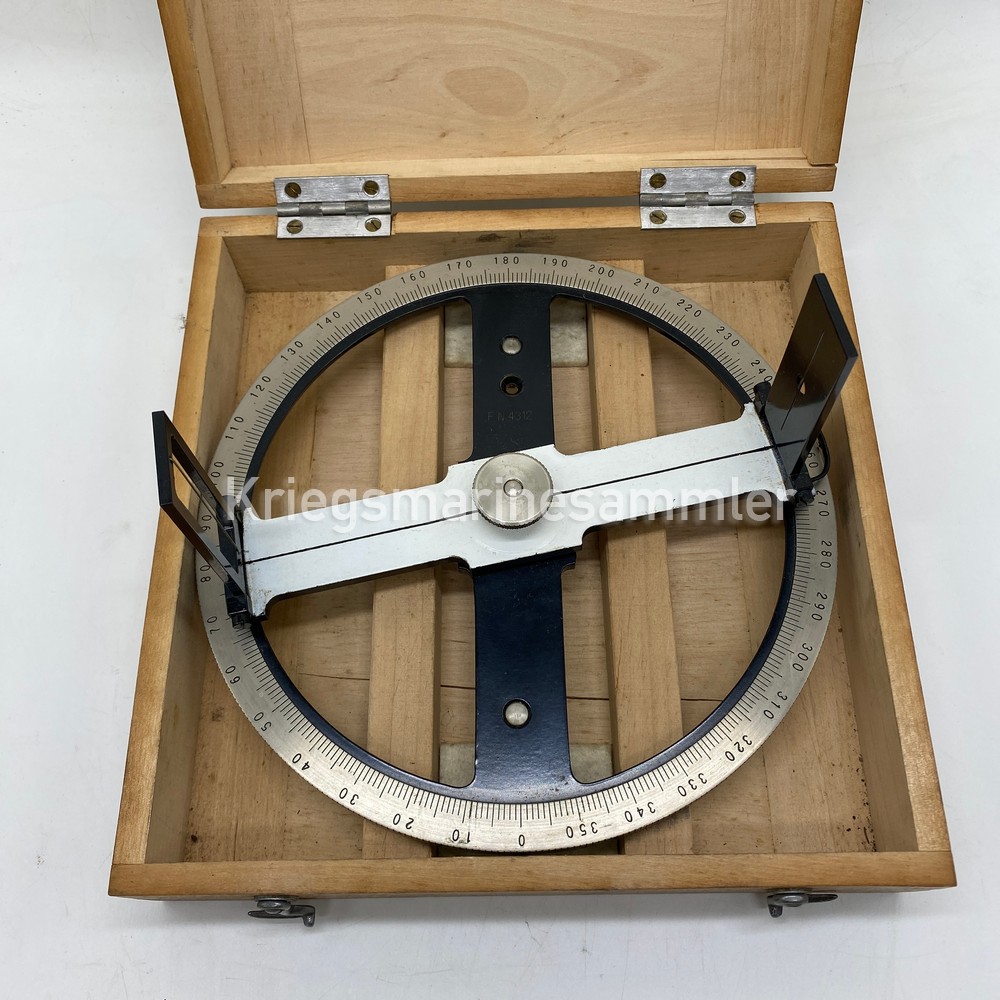
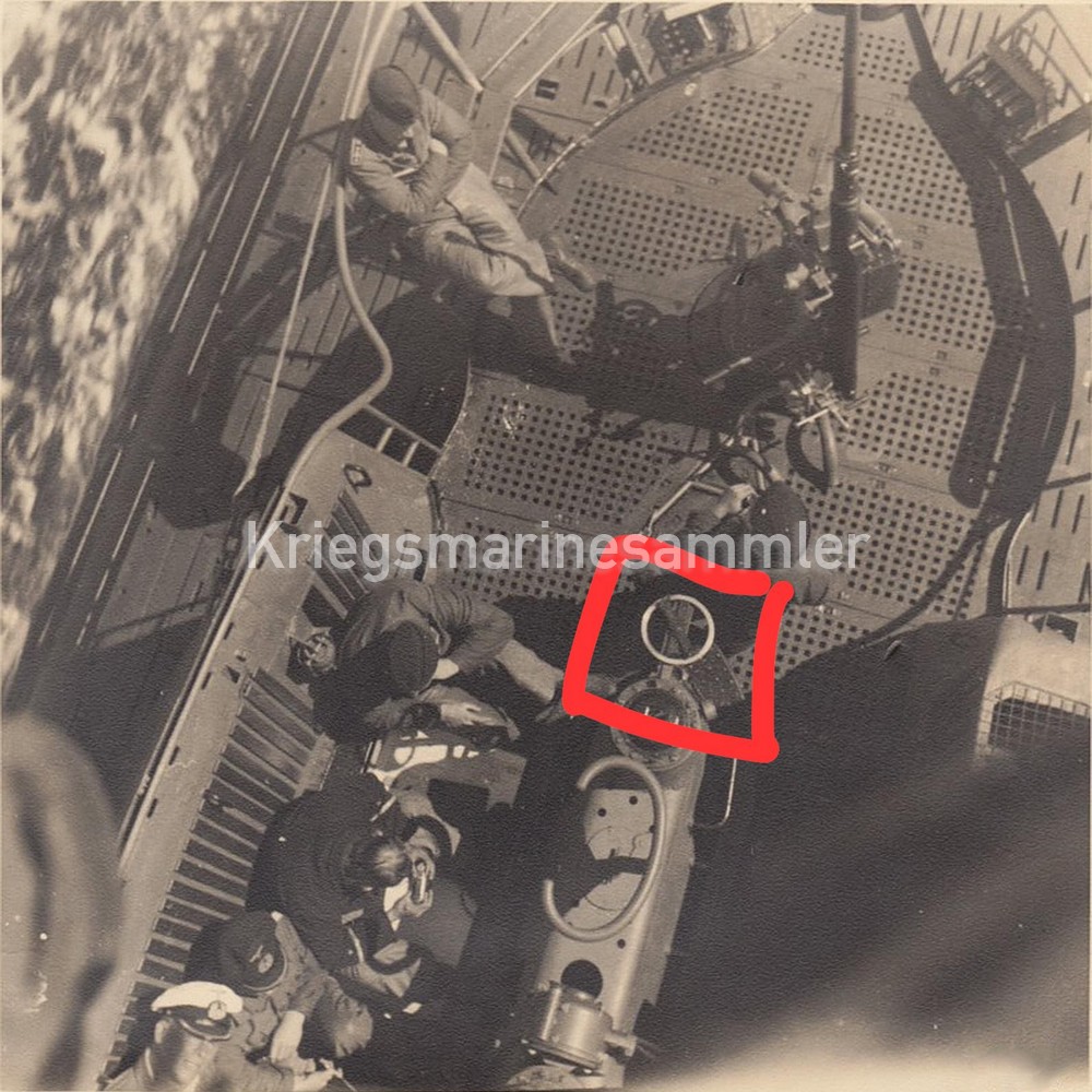
Late war Peilscheibe in its box marked with its M nr. on top of the box. The Peilscheibe was used on Ships but also on U-Boots with a rare Picture showing this device. Its used to determin a certain degree from a sun or ship, and compare which course the ship was going compared to the sighting.
Kriegsmarine C Plath Peilaufsatz for E-Kompass
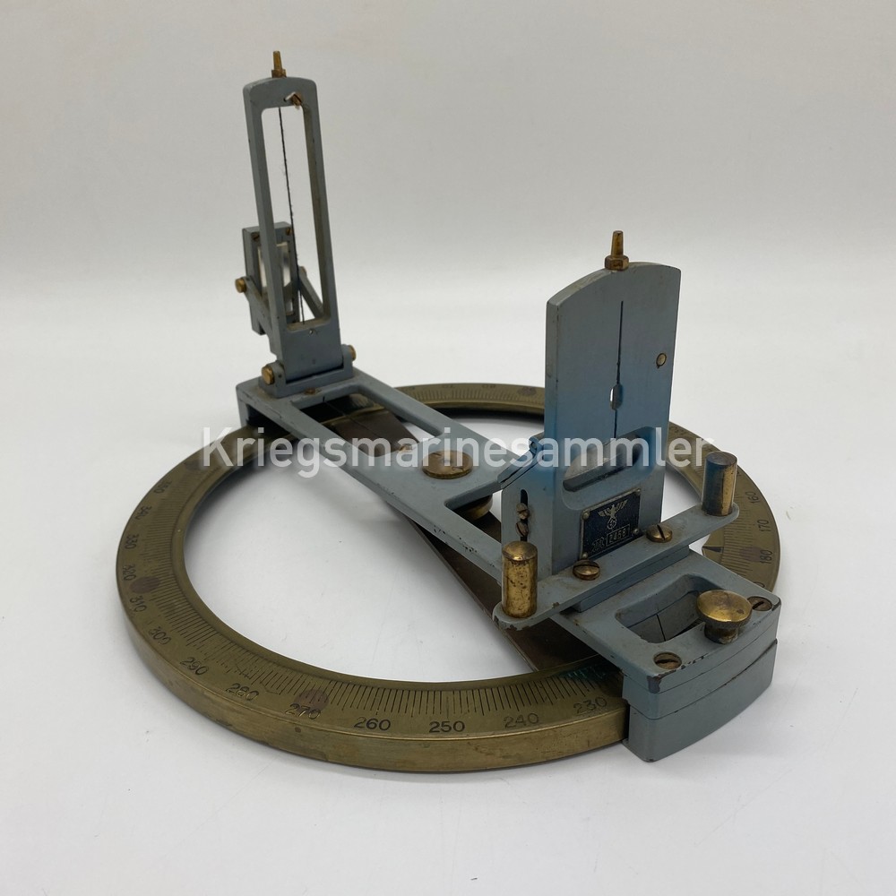
Peilaufsatz/azimith made by C. Plath to be mounted for E-Kompasses(Anschütz & Co) nicely marked with its producer plate and Eagle + M on the front side. The Peilaufsatz was used on Surface vessels/ships only. Its used to determin a certain degree from a sun/ship or point, and compare which course the ship was going compared to the sighting and Degree from the E-Kompass.
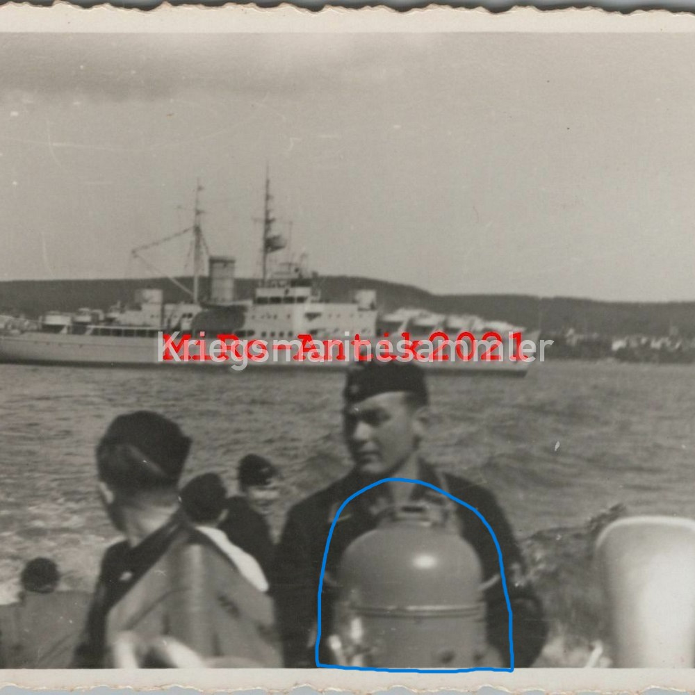
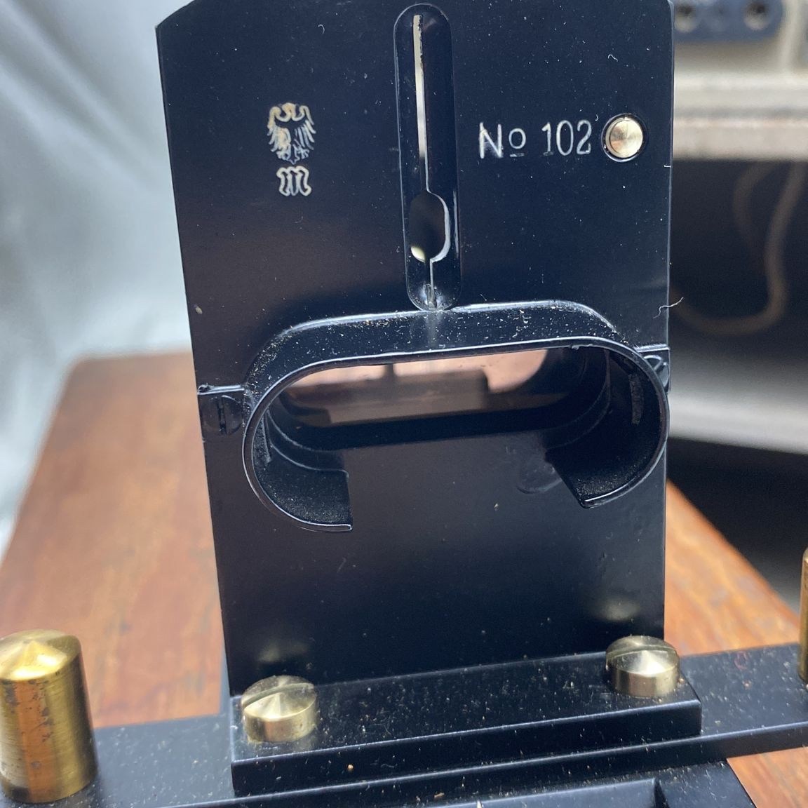
Kriegsmarine U-Boot Peilscheibe


Peilscheibe nicely marked with its producer and Eagle + M on top. The Peilscheibe was used on U-Boots and other ships, shown are rare pictures with this device. Its used to determin a certain degree from a sun or ship, and compare which course the ship was going compared to the sighting.
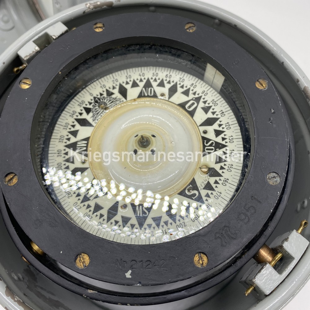
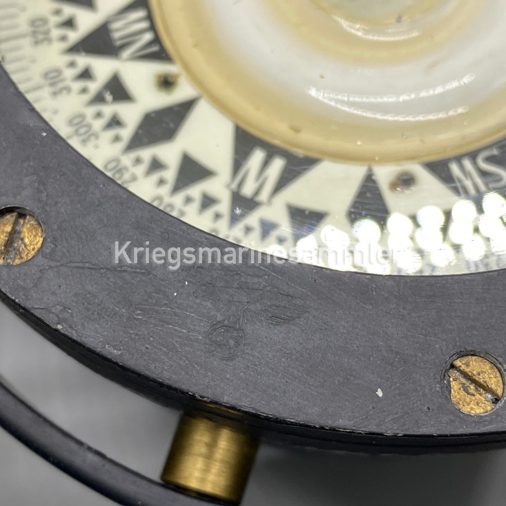
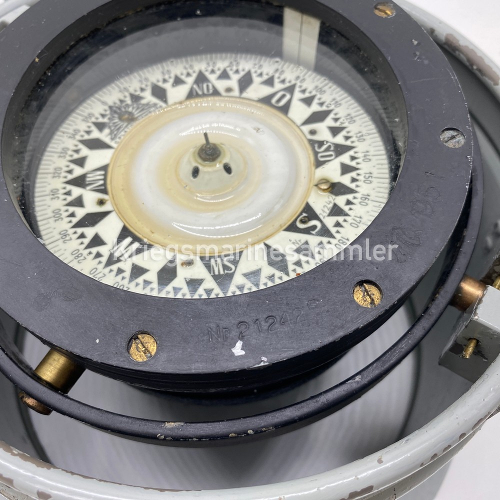
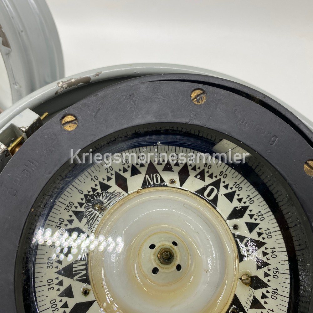
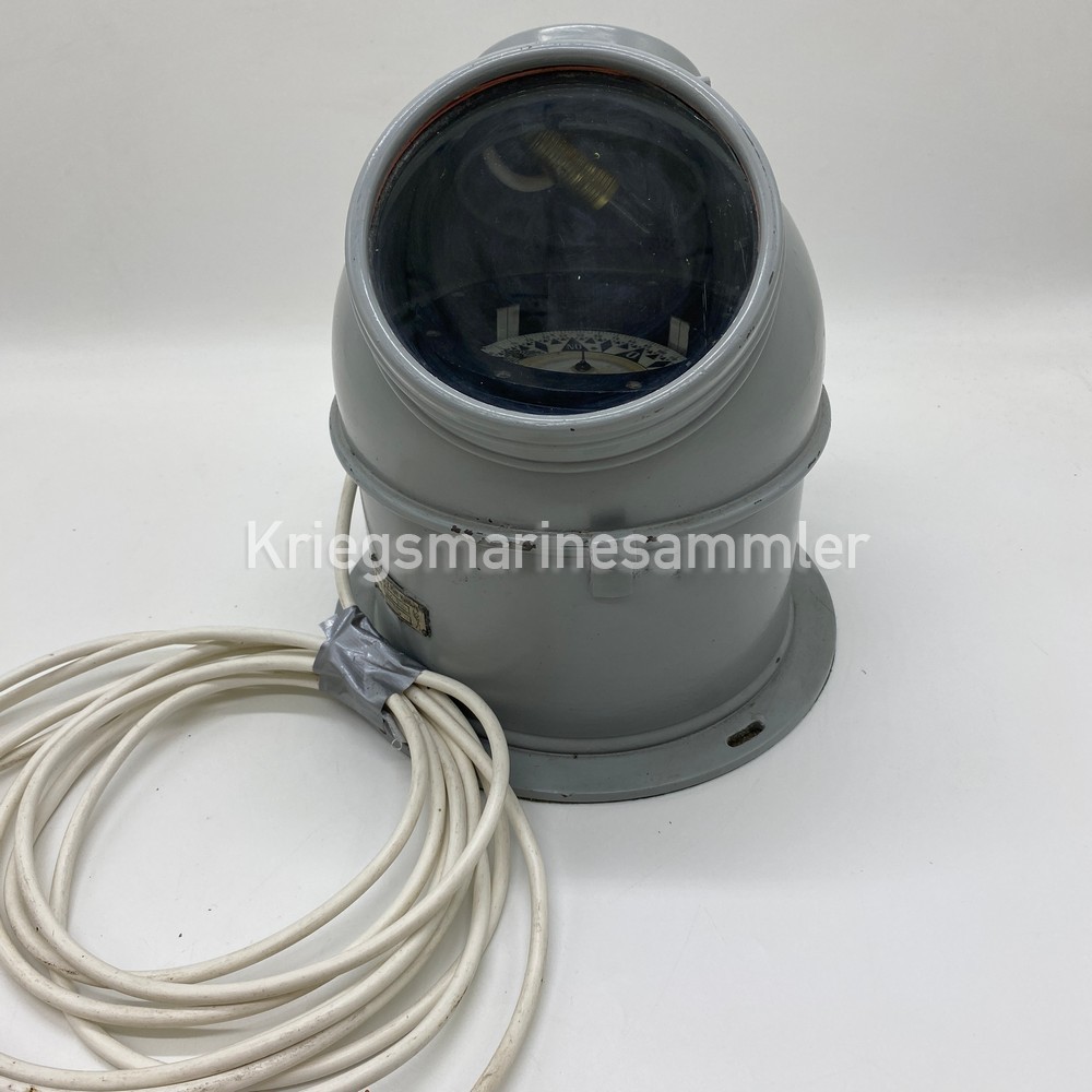
Kriegsmarine C. Plath Reserve Schiffskompass

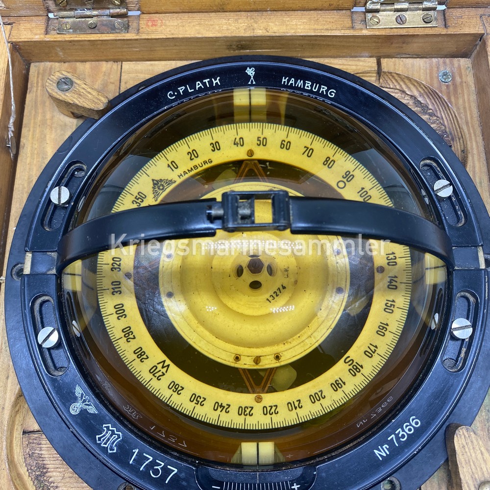

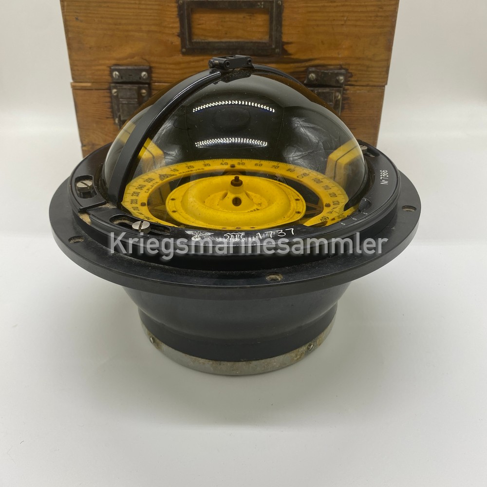
Kriegsmarine Schiffskompass together with a very rare Reserve/Spare or Storage box. This compass was normally mounted in the small saule. But in this case the compass in stored in a wooden box which is very uncommon and rare. The compass is in very good condition with all of its original fluid and marking still visible on the ring.
Kriegsmarine U-Boot C. Plath Hamburg Sextant
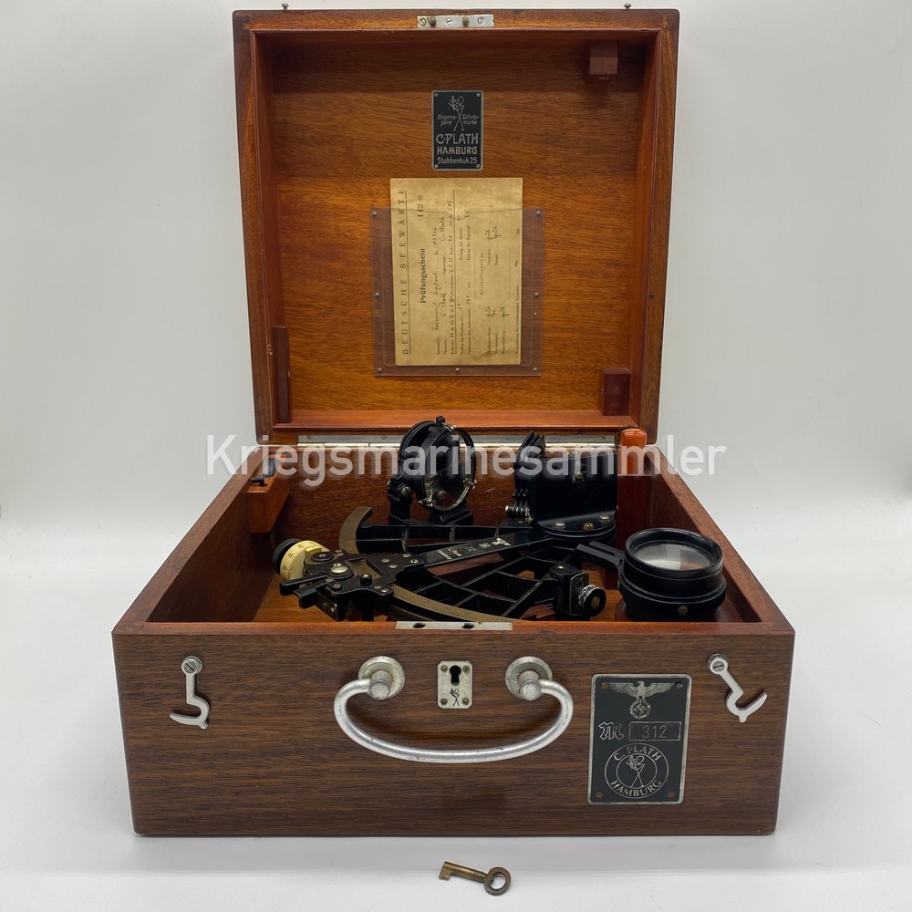

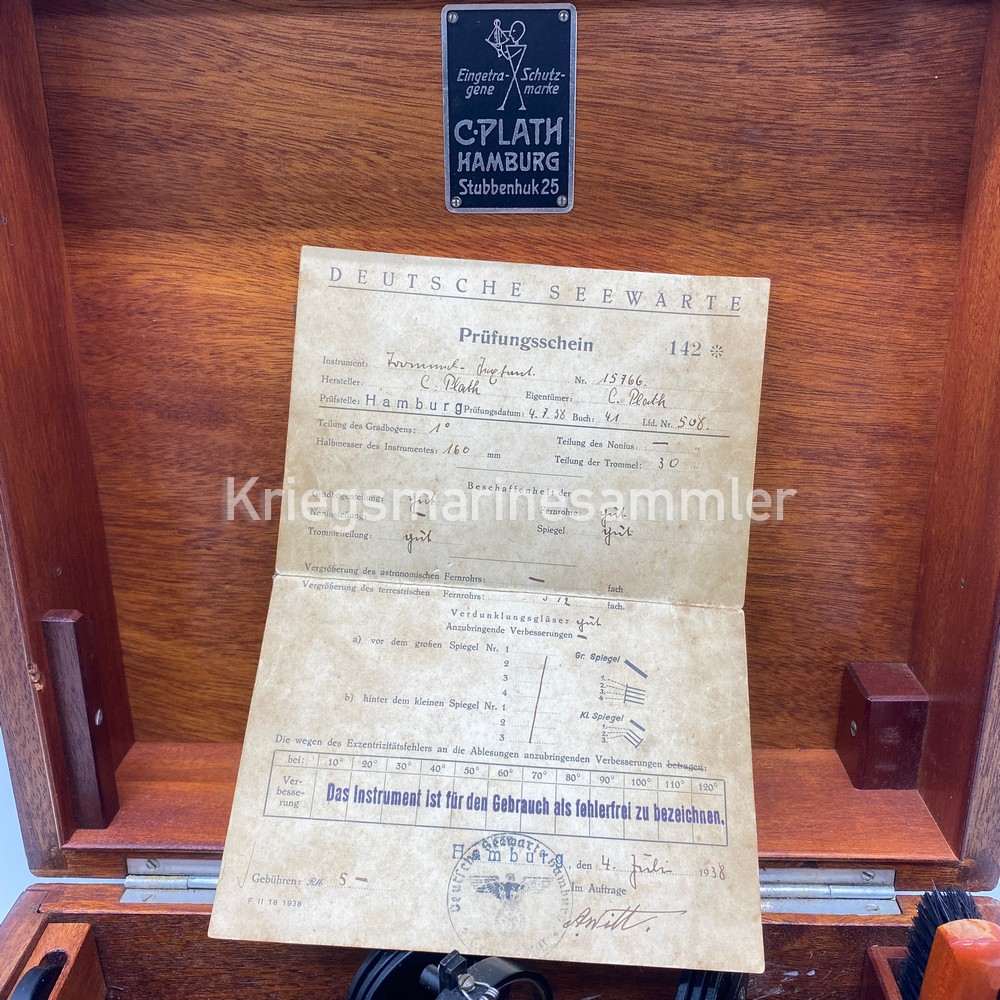
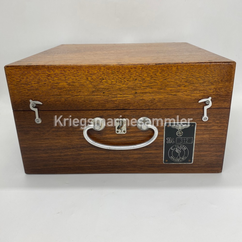

A Very fine complete set of a Kriegsmarine Sextant. Produced by C. Plath Hamburg. Used in U-Boot and other Kriegsmarine Vessels. This Original Kriegsmarine Sexant is an early model which comes complete with every part and also its very rare plate on the front. All items are in very well condition. The Sextant also comes with the key to close the box, which is also something very rare. Unusual to find a set like this. This sexant would be used to determain their position by measuring angle of the Sun and the Horizon of the Sea. With this information of their current angle and time it was determained they need to calcutate their position line on a chart and Hereby know their current Location on the Ocean/Sea. This is one of the most common Typical Nautical instruments.
Kriegsmarine S-Boot C. Plath Peildiopter with Cover


A fully complete Kriegsmarine C. Plath Peildiopter set in its original box. Used on top of C. Plath Schiffskompass as seen in the last picture. Complete in its Box and also with its full round Kompass cover is very rare and almost unseen. It covers the Kompass’ dial from any incomming sunlight, where then the dial is lit by the inner Light bulb. The Peildiopter on top is used to identify the bearing of the sun or position of a ship where the operator can read the Magnetic Bearing on the dial by looking through the optic which shows 2 screens. The Peildiopter has Multiple sun screen lenses and mirrors for using the sun as bearing.
U-Boot MHR1 Marine Hohenrechenschieber

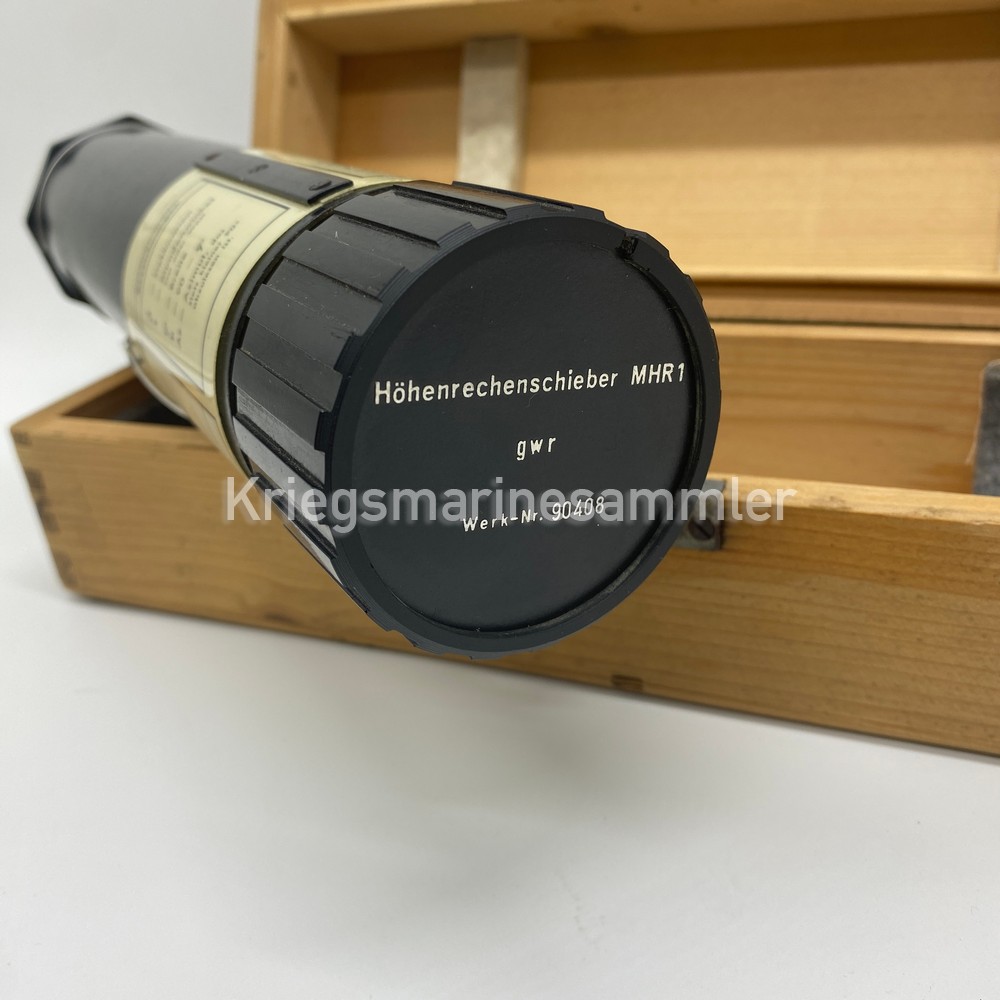


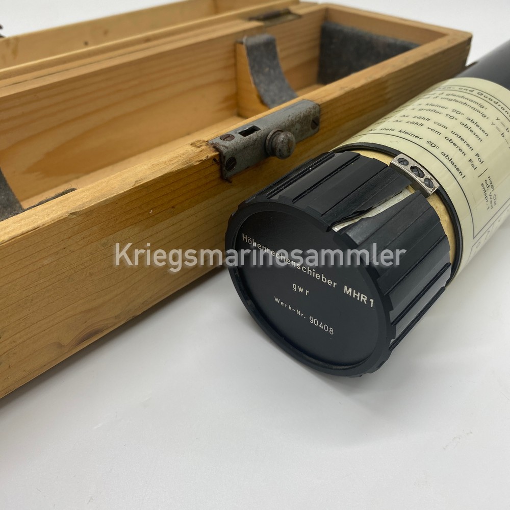

A very rare item also named the Hohenrechenschieber MHR1. Which was used together with the starglobe to calculate the Azimuths and true height of a star. A very special designed item which main purpose to locate their U-Boot in the Sea . Produced by Dennert & Pape (gwr). Sadly 1 Bakelite part of the MHR1 seems to be expanded due the age and it cracked the handle of the ruler. Although not visible when turned correctly. The last picture shows 2x MHR1’s in use together with the Starglobe.
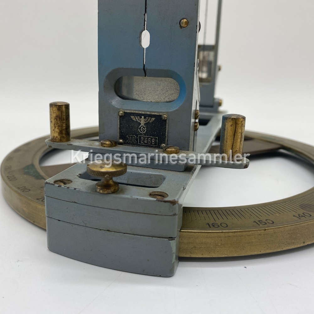
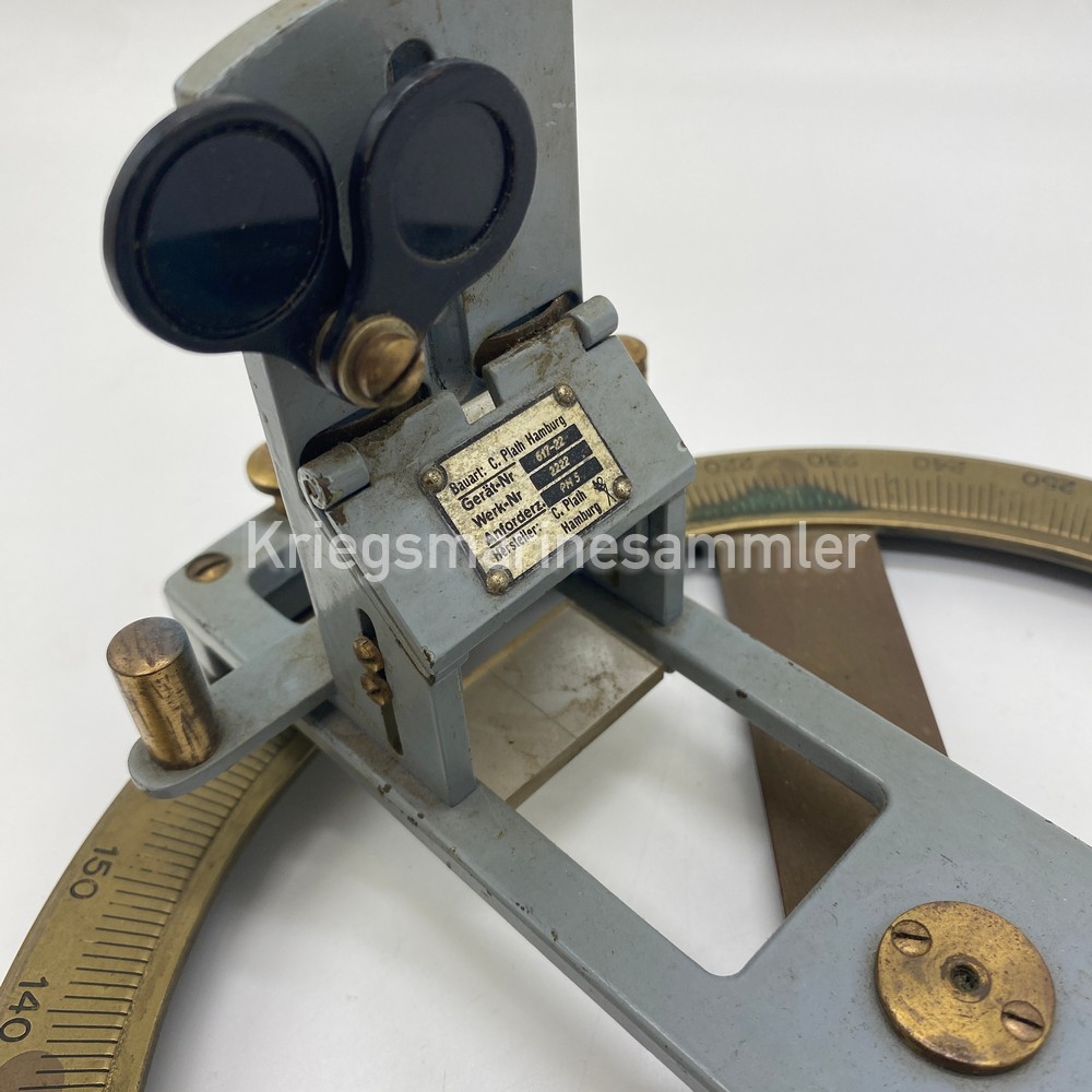
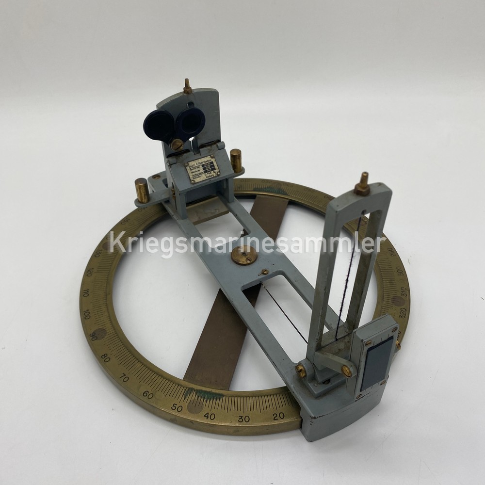
Kriegsmarine U-Boot SKS-3D SeeKreiselsextant Bubble/Gyro Sextant
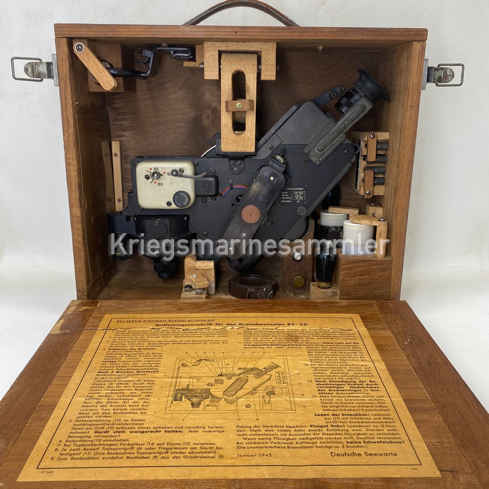


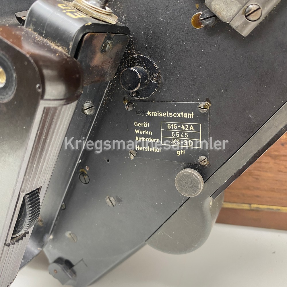
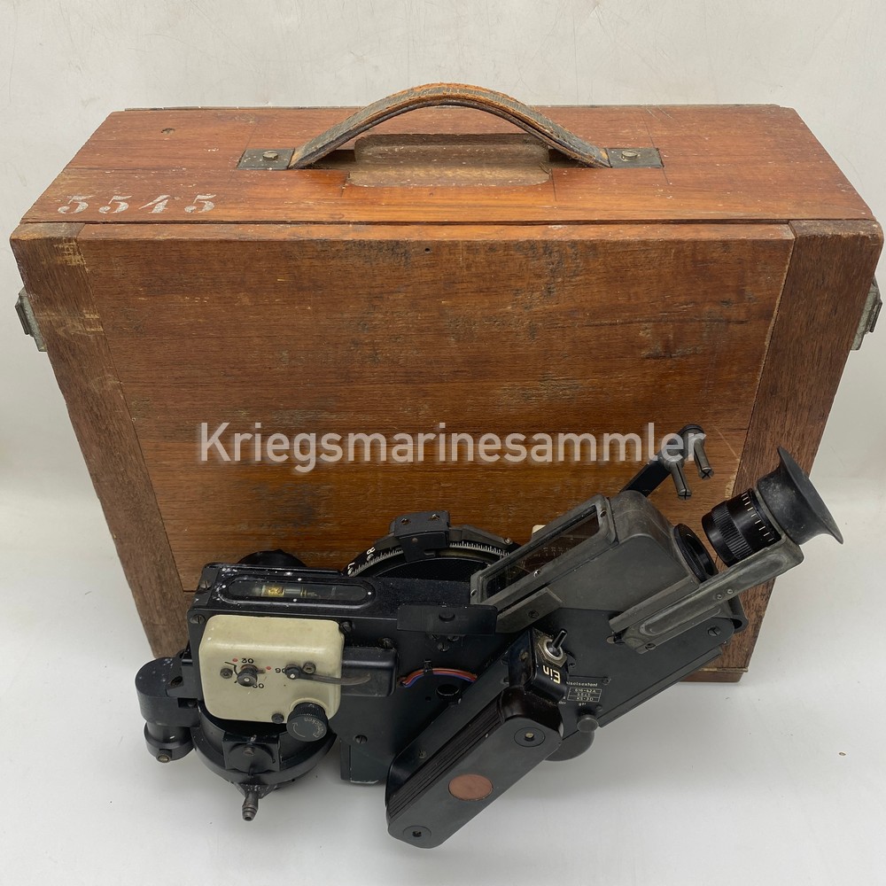
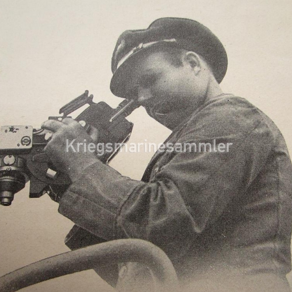
A fully complete Late war U-Boot Bubble/Gyro Sextant also called the Seekreiselsextant SKS-3D. Produced by ‘gtl’ also known as C. Plath. These Sextant where the new future for navigational purposes they could be used both during day and mostly night. So U-Boot crews could also submerge during the night and find out there location. Which means there was less danger then submerging during the day. It’s fully complete with 2x batteries, battery charger, handle, all of its sun shades and all of its lamp.
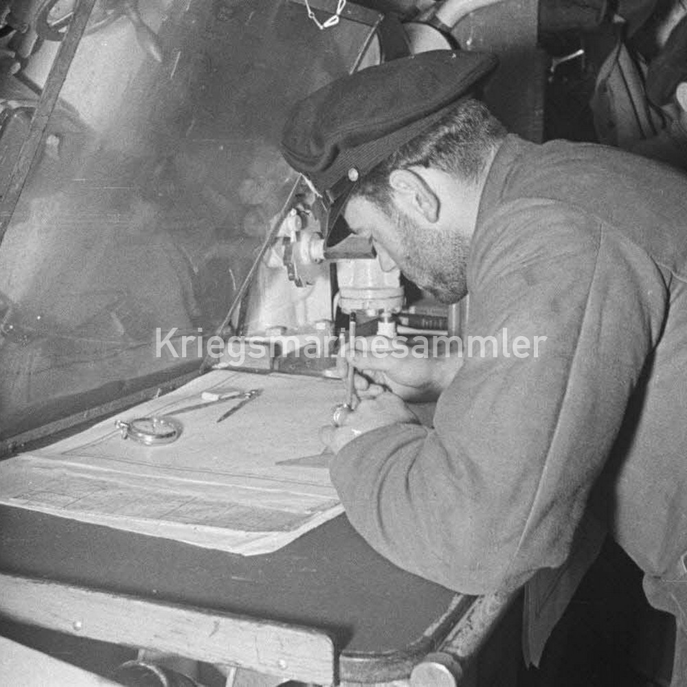
Kriegsmarine U-Boot Map Tools
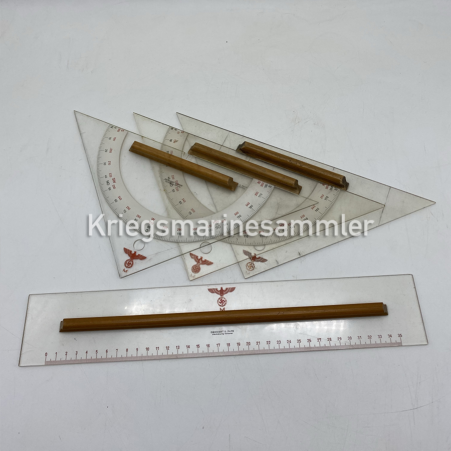
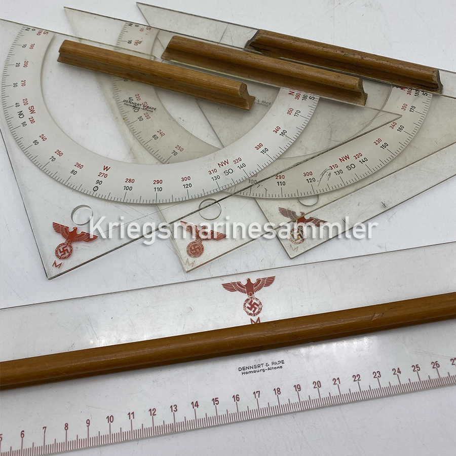
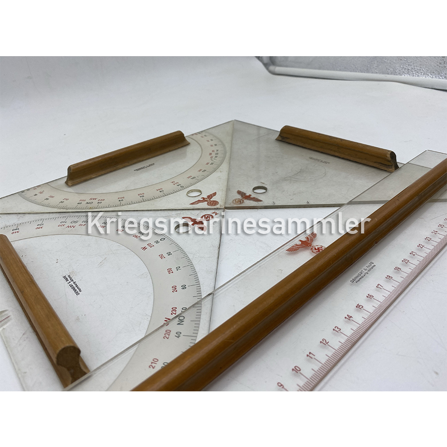
Kriegsmarine or U-Boot Navigation map tools, very important for every navigator, used for plotting or many other options. Seen underneath is also a very rare Kriegsmarine ruler which I have never seen one before beside one from U-534 Liverpool, a waterfind. These would have been used on every ship, or boat on every map table.
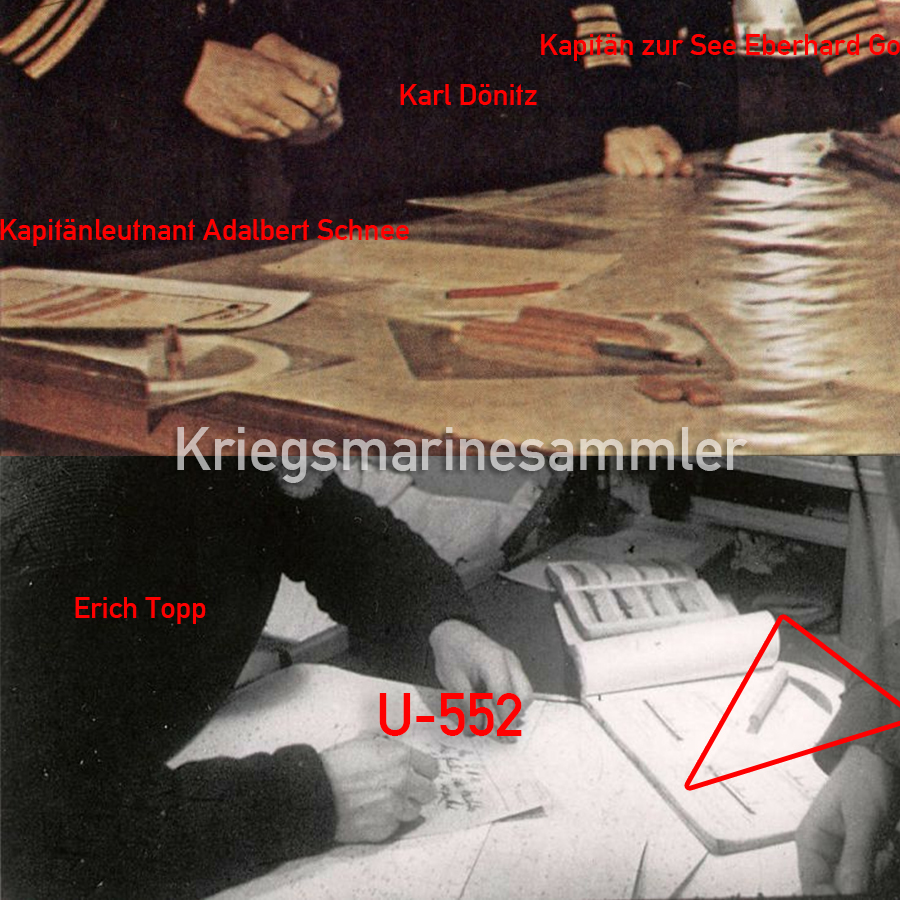
Kriegsmarine U-Boot Deuta Werke Anemometer

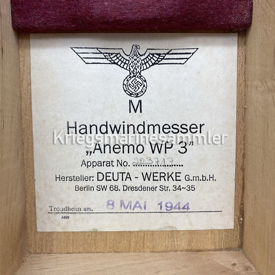
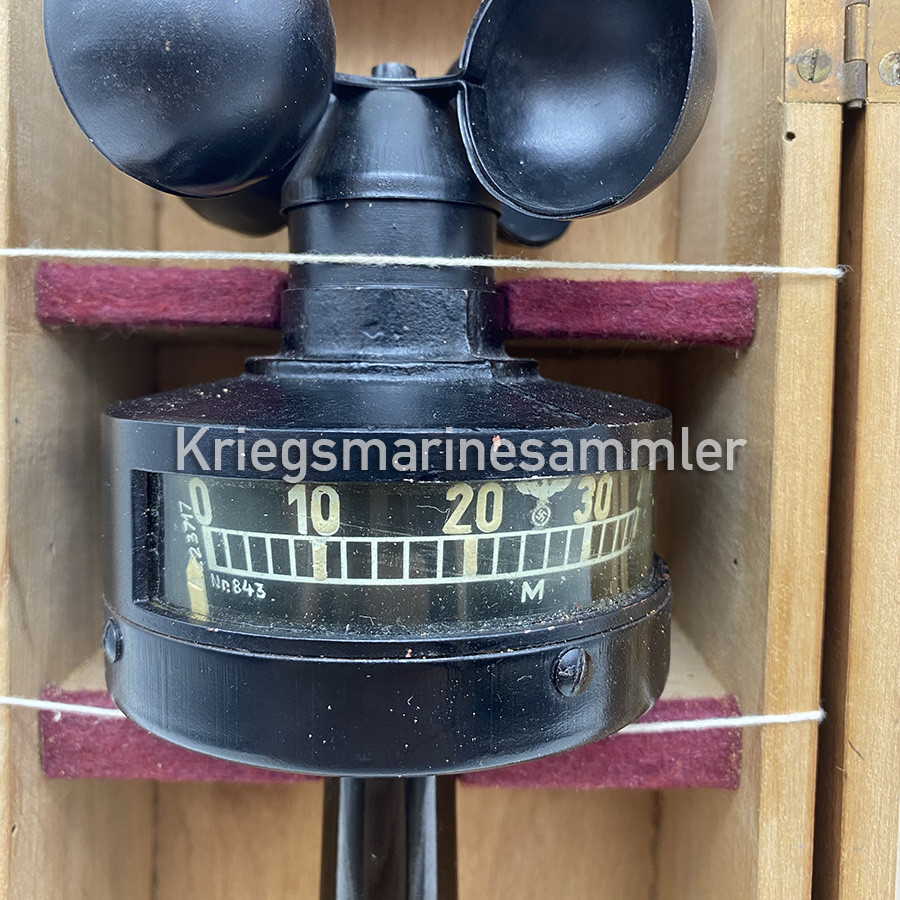
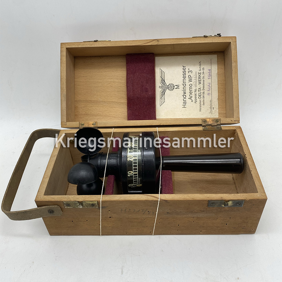
Kriegsmarine U-Boot Handwindmesser ”Anemo WP3” also called Anemometer from 1944. Made out of bakelitein excellent condition. The Anemometer is a device used for measuring wind speed and direction. It is also a common weather station instrument. A rare item you don’t see show up everyday. This model seems to be approved at Trondheim which was a very important U-Boot base in Norway during World war 2.
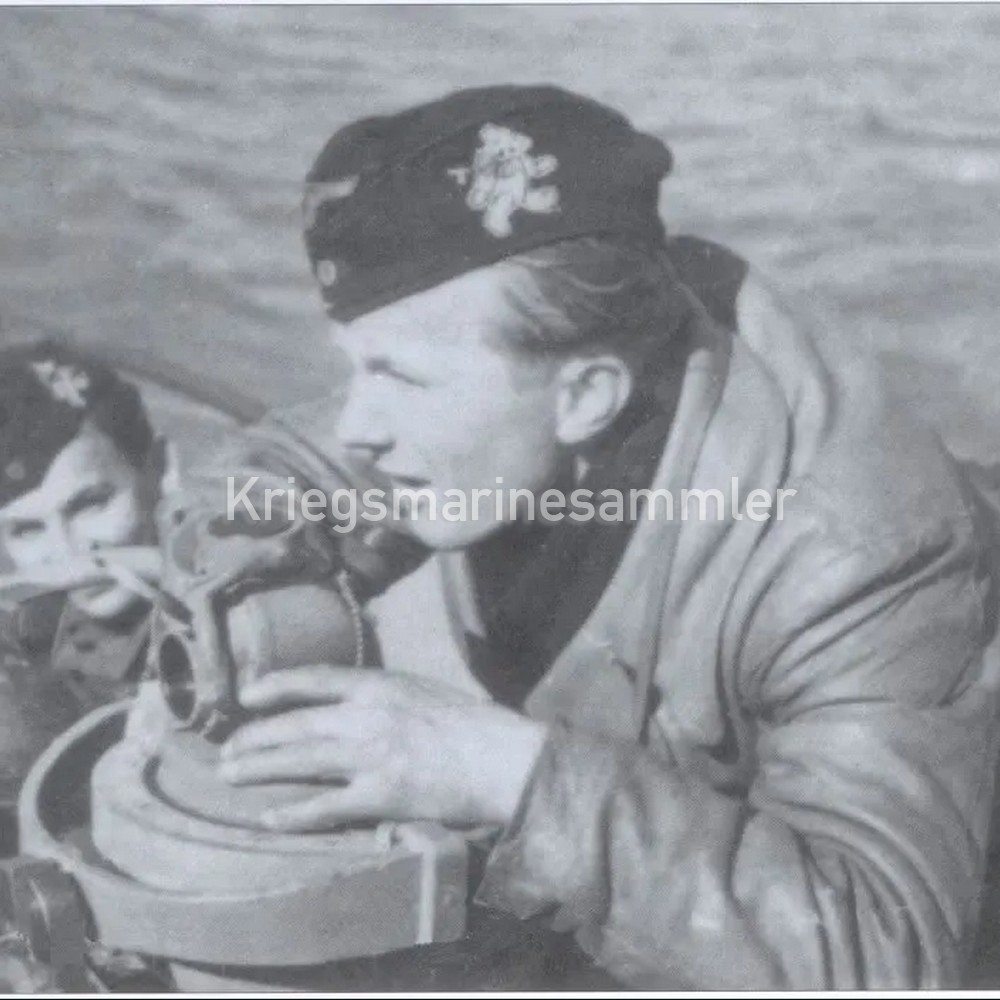
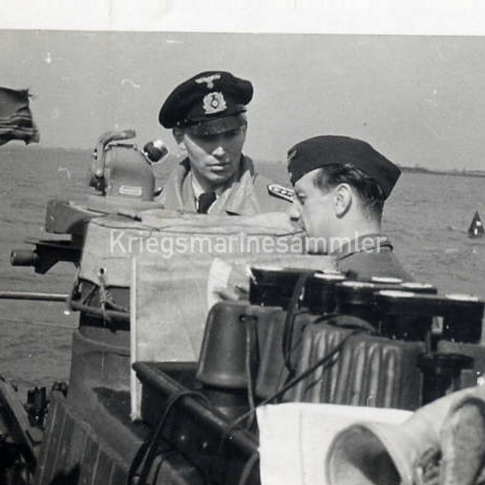
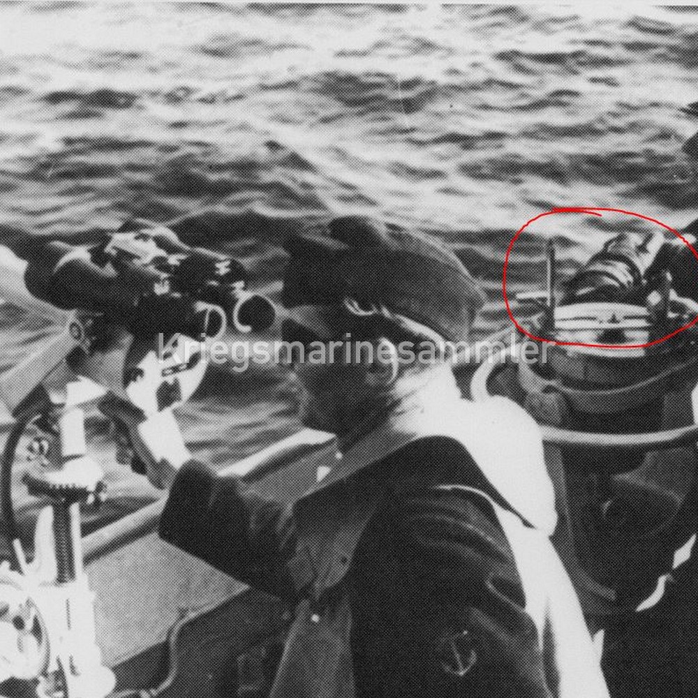
U-Boot Anschutz & Co Fernrohrpeilaufsatz


U-Boot Anschutz & Co Kiel Fernrohrpeilaufsatz Peildiopter Azimuth. Model S1350 nr. 2900. This item fits only on the Druckfester Tochterkompass/Pressure Proof Gyro Repeater model S2251. It was mounted on the Repeater and used to find a certain bearing for example a ship. A really rare item, but used on every U-Boot with a Gyro Repeater on the Turm/Conning tower. With 2 reference pictures attached, one shows an empty holder where this complete set would be positioned, labeled ‘Peildiopter’. While the second pictures shows this Peildiopter in use on the famous U-96, a very frequently used item for navigation.
Kriegsmarine C Plath Schiffskompass in housing
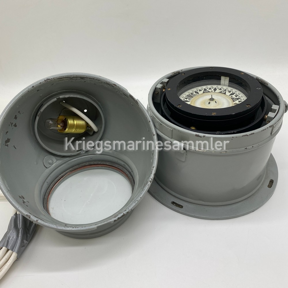
Kriegsmarine C Plath Schiffskompass in its housing. This is a smaller type compass, all marking and plates are still there and visible. The housing is marked with a C Plath Typeplate, and the ring of the compass has all its markings (it is repainted what makes it harder to notice, but enough pictures are provided. The compass comes with a long cable (no plug) which is attached to a lamp inside. When wanted this compass can be lit up for a nice display.
Kriegsmarine/Reichsmarine Peilaufsatz

Kriegsmarine and Reichsmarine Peilaufsatz in original box. With multiple markings, Reichsmarine eagle and Anschutz & Co, Kiel on the peilaufsatz and M marking on the box. This item was made for the Reichsmarine but as you can see on the picture this was also widely used in the Kriegsmarine.
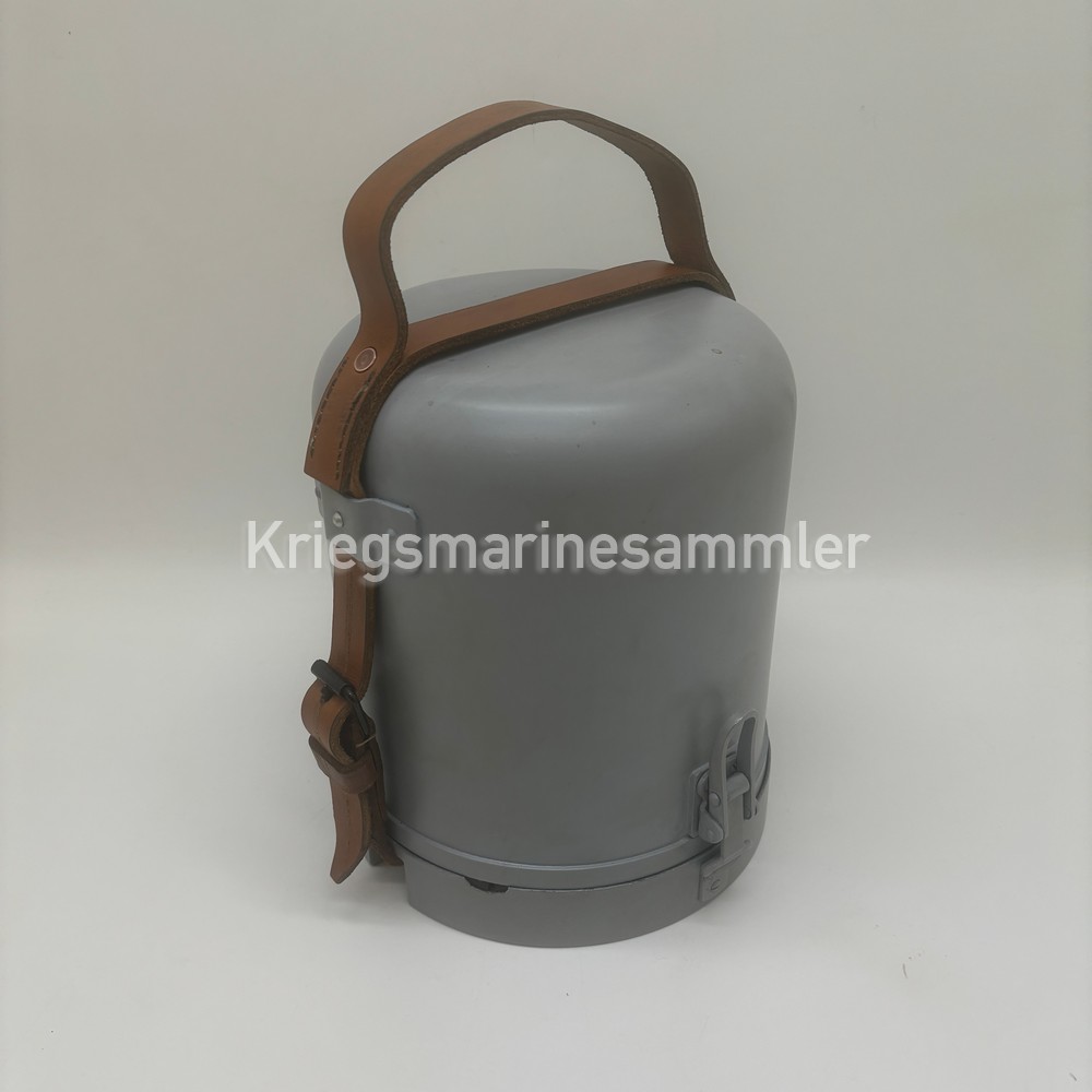
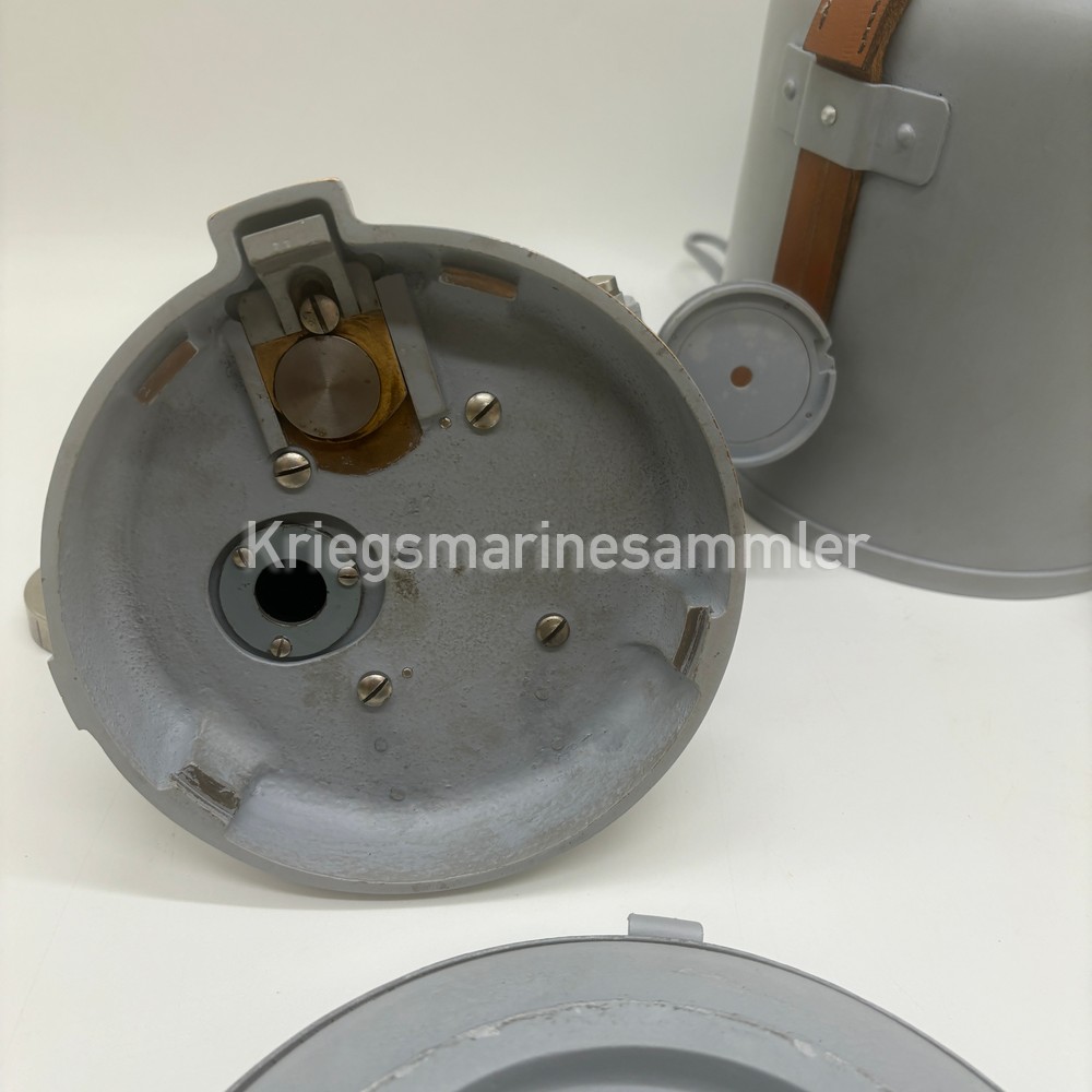
Kriegsmarine U-Boot Lufft Barograph

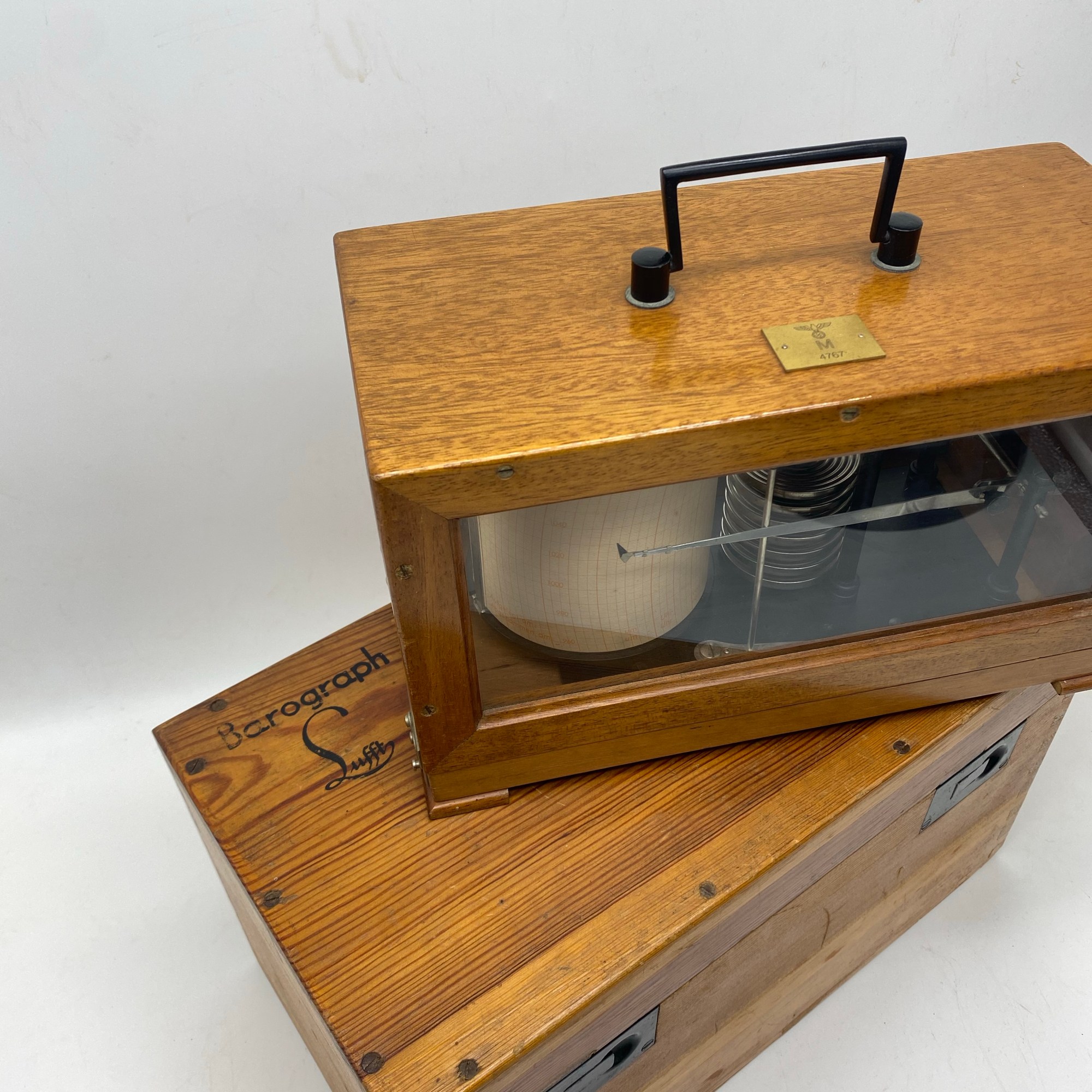

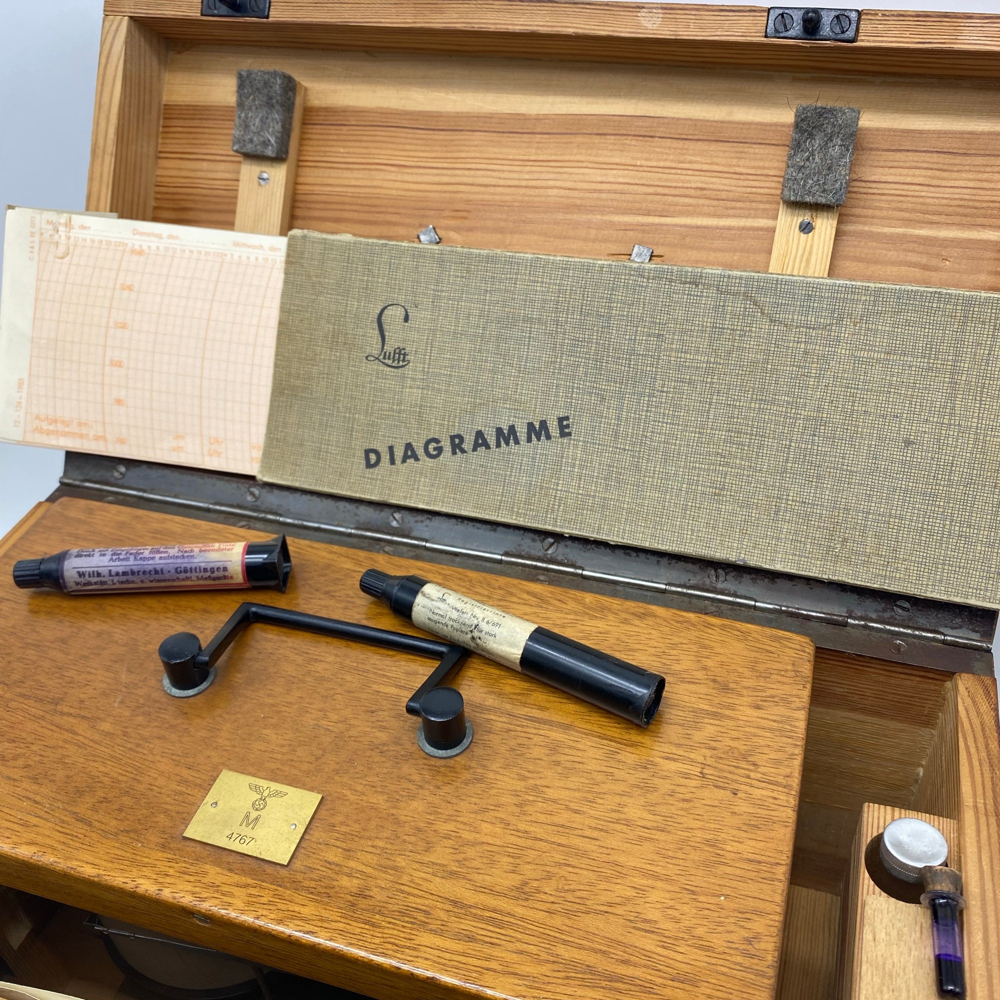

Full complete set of a Kriegsmarine U-Boot Barograph made by Lufft. This item measures the Barometric pressure over time and draws the value overtime with inkt on paper on a slowly turning drum that can be winded. This Barograph still has its transport box, spare inkt and allot of ‘Diagramme’ papers for usage, still all in working condition and nicely marked with a plate on top.
Kriegsmarine Thermograph Instrument

Kriegsmarine Thermograph, this item was used to write down the temperature on the rotating drum/paper with a needle and ink. The drum that can be winded will last for 7 days, which gives a weekly report of the temperature. A bit similar to the Barograph which is used for baromatic pressure.
Kriegsmarine U-Boot Seekarte Elbmündung / Cüxhaven November 1944


For sale is a November 1944 Seekarte / Nautical chart. In good condition, used for U-Boot navigation and other vessels too. Also a late war example.
Kriegsmarine U-Boot Seekarte Dungeness bis Orfordness und Strasse von Dover März 1945

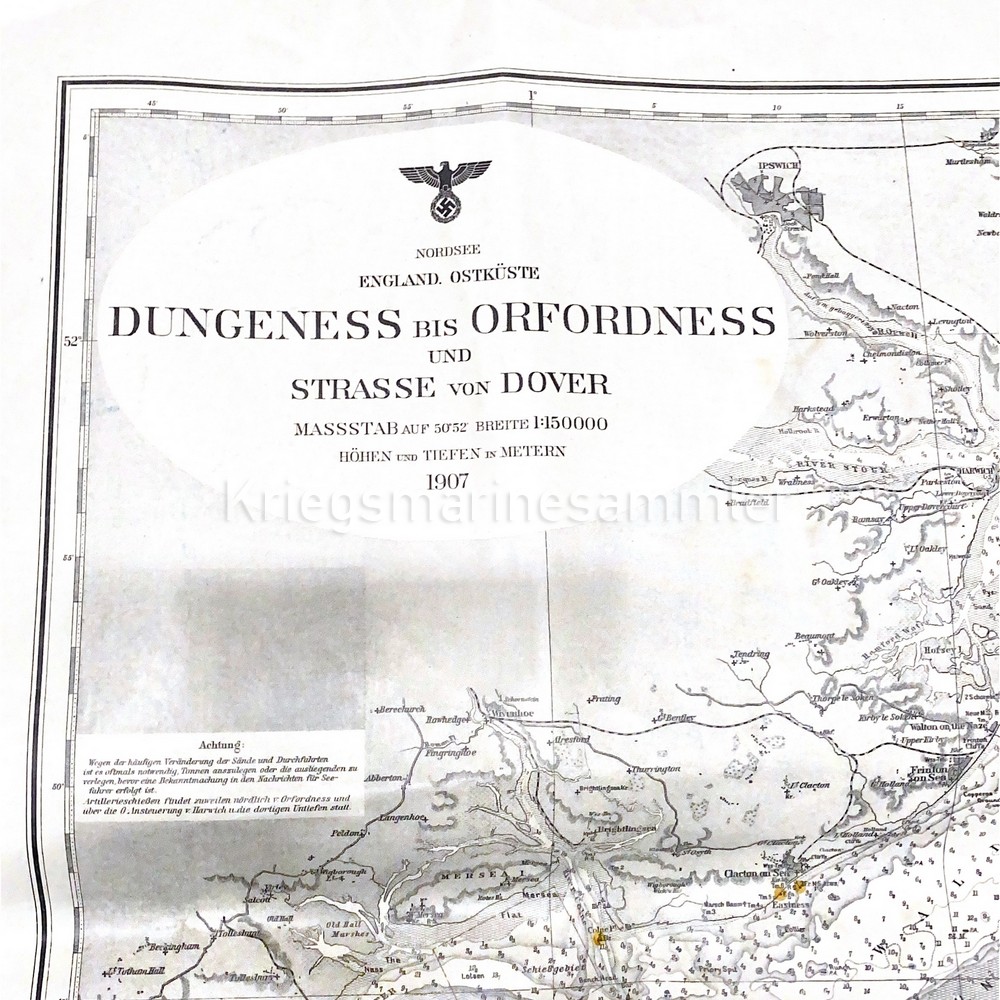
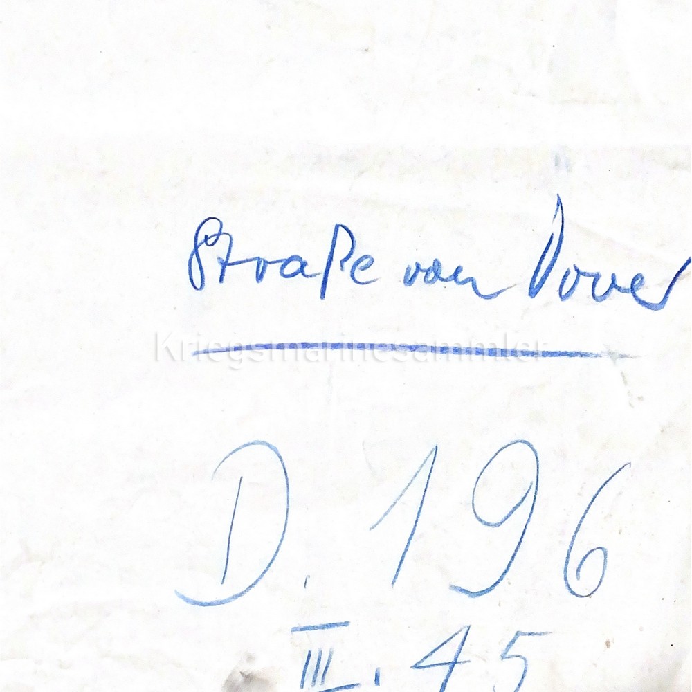
For sale is a March 1945 Seekarte / Nautical chart. In good condition, used for U-Boot for navigation and other ships too. This being a very late war chart is very unique.
Kriegsmarine Bakelite Kompass KM/DS Sept 1942
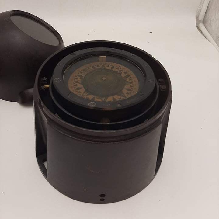
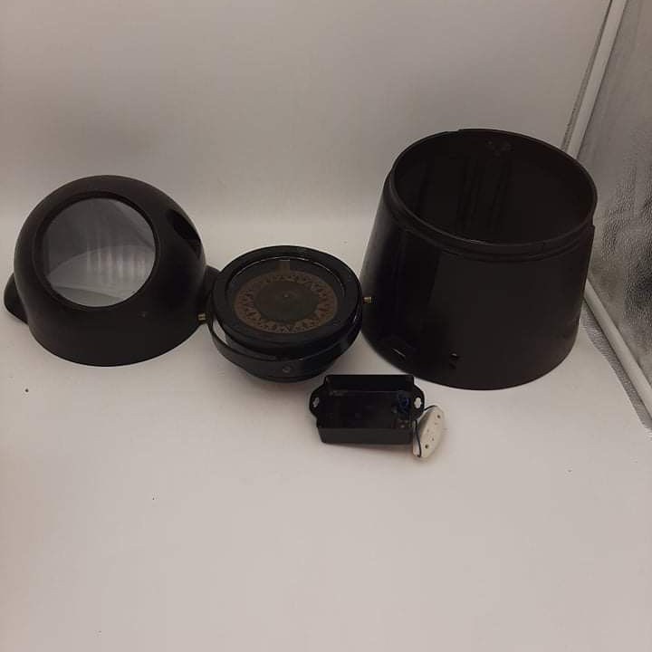
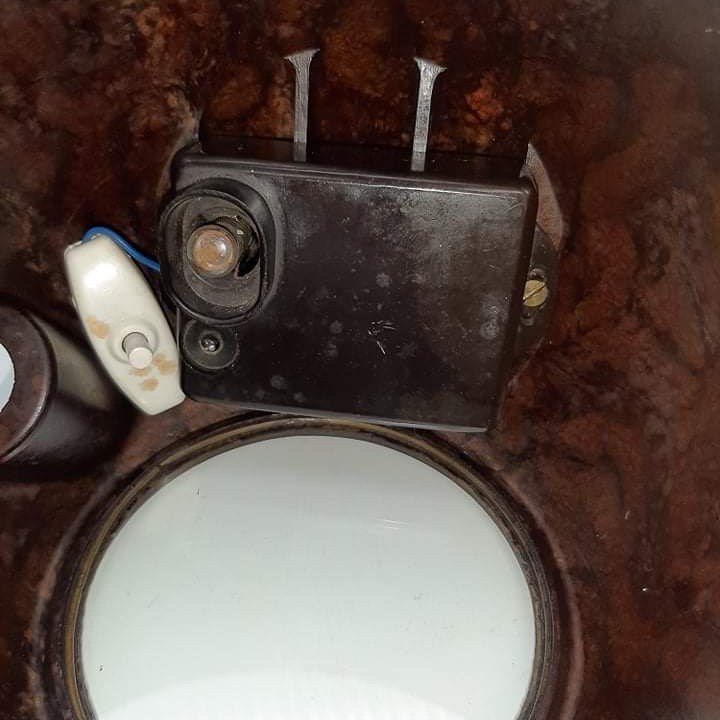
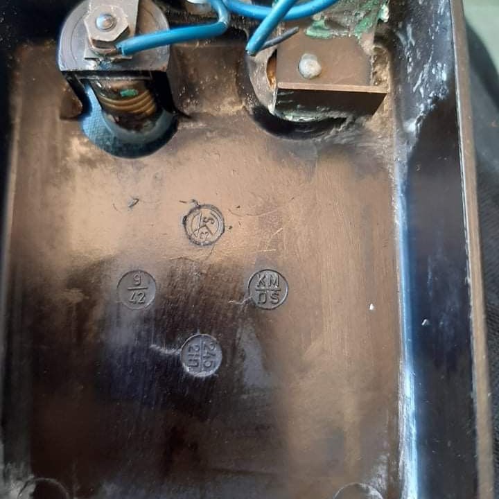
Kriegsmarine Schiffskompass in bakelite housing. Bakelite has no cracks or signs of damage. Inside the bakelite housing are multiple markings, KM/DS which means (Kriegsmarine/Deutsche Seewärte) or 9/42 which means September 1942.
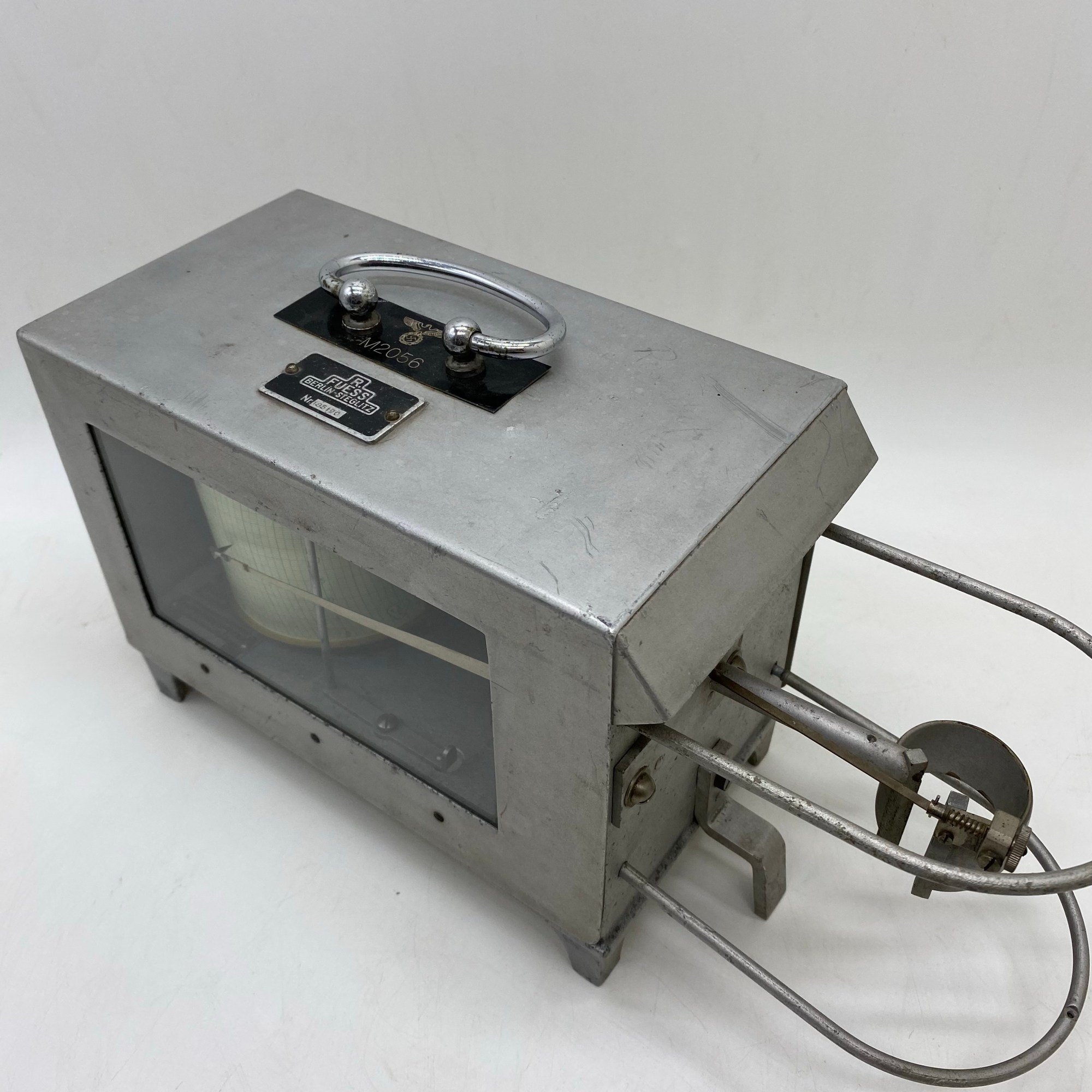
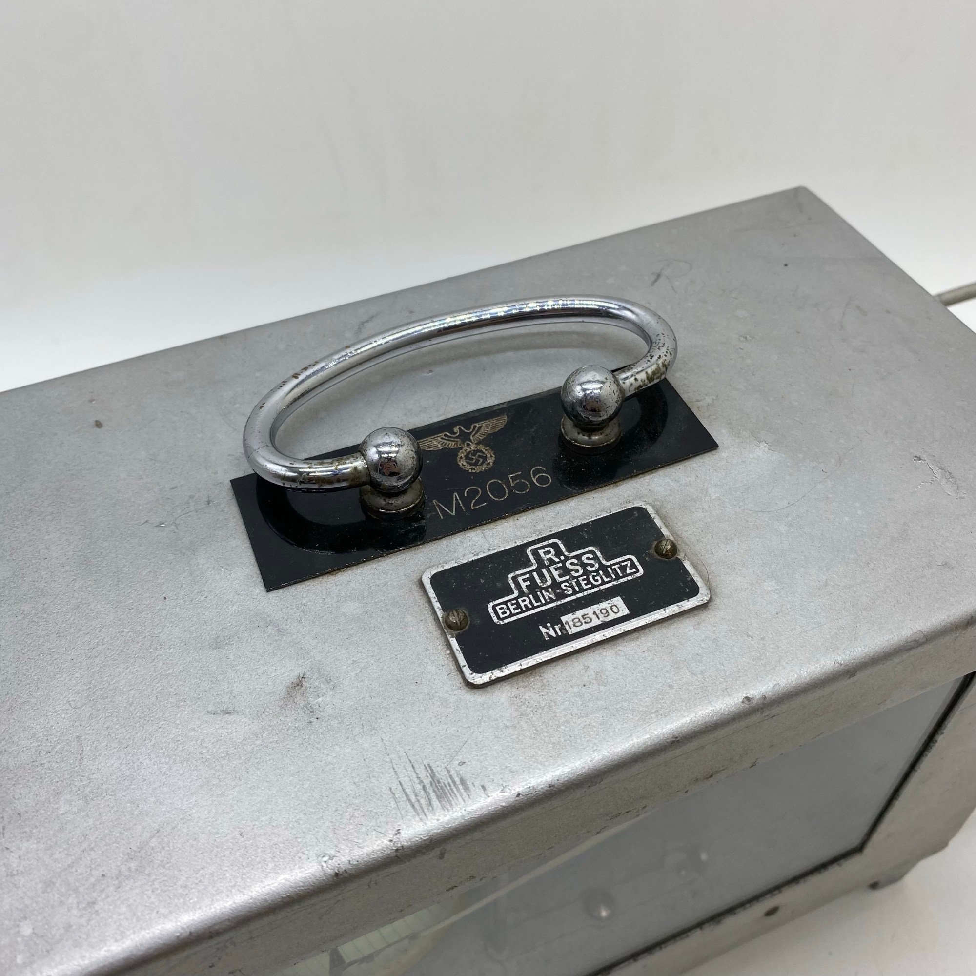
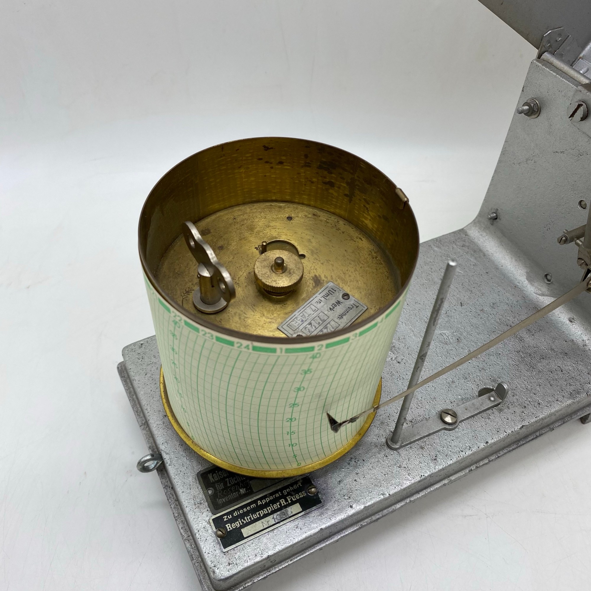
R Fuess Steglitz Barograph Kriegsmarine U-Boot
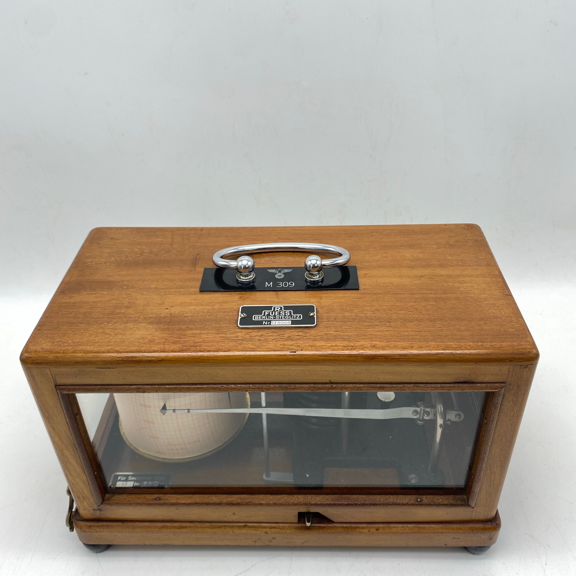
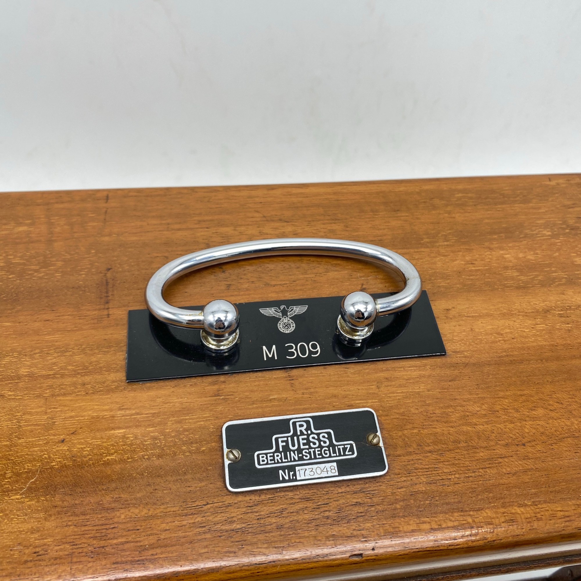
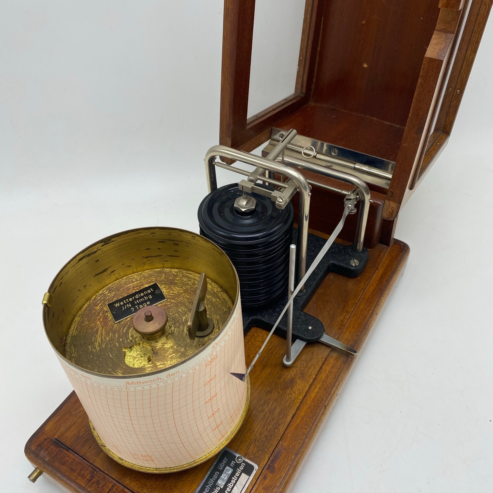
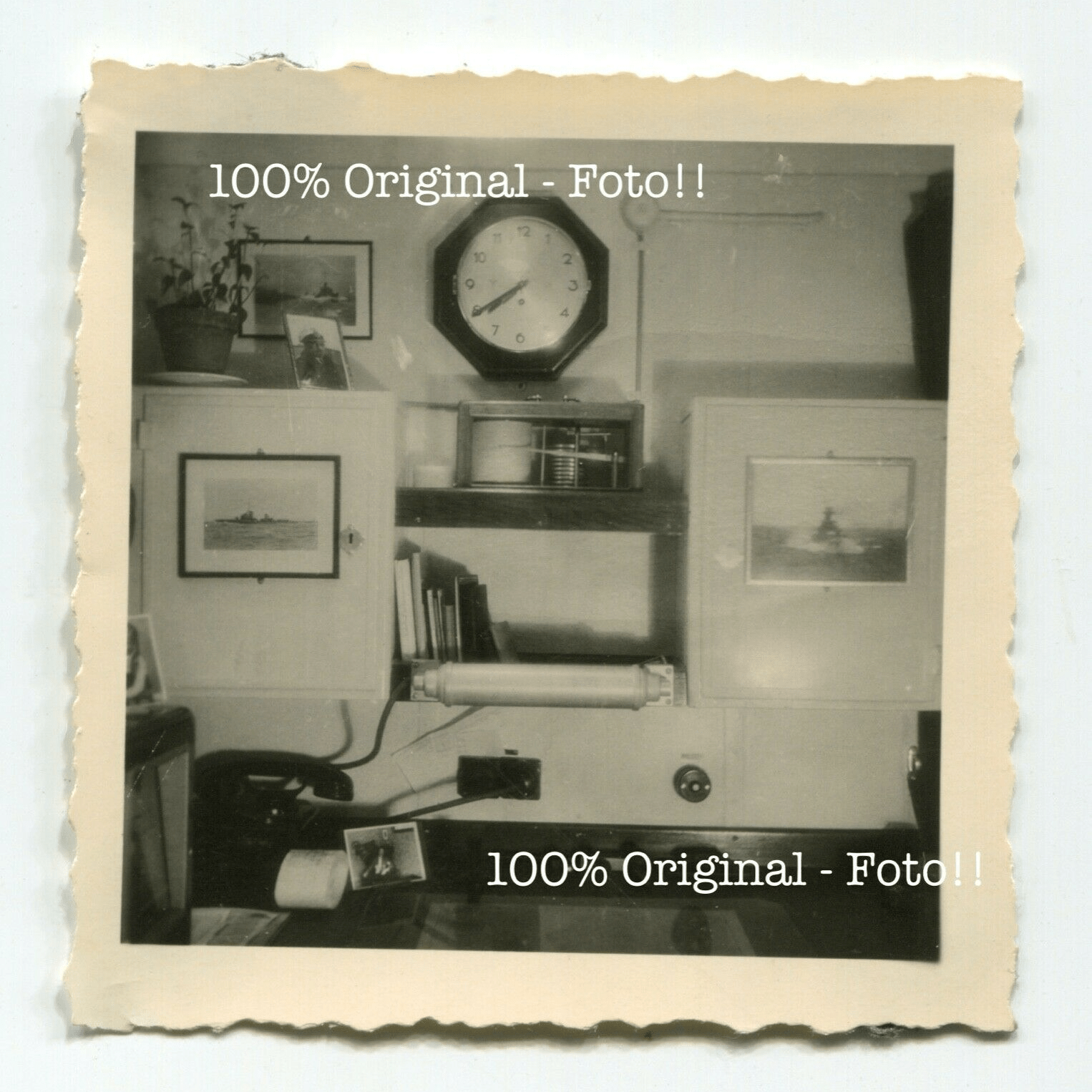
Kriegsmarine U-Boot R Feuss Steglitz Barograph instrument in excellent condition for sale . This item measures the Barometric pressure over time and draws the value with a needle and inkt on paper on a slowly turning drum that can be winded. On the last picture you can see the exact same R Fuess Barograph with same the recognizable handle .
